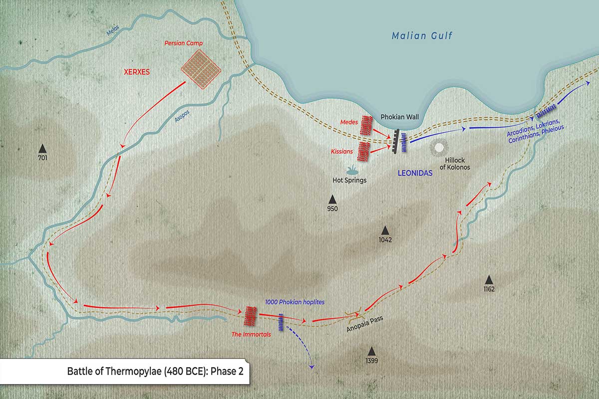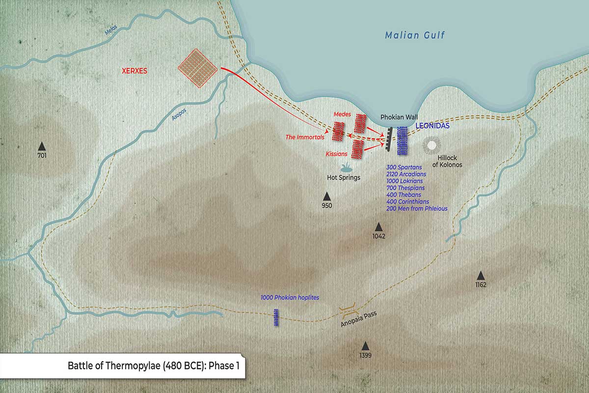
This map depicts the first phase of the Battle of Thermopylae. The Persians begin frontal assaults at the Phokian Wall while Greeks hold the narrows and post a guard over the back-door route (Anopaia Pass).
Key Geography
-
Phokian Wall: Barrier across the road beside the shoreline—main Greek position.
-
Hillock of Kolonos: Small rise just behind the Greek line.
-
Hot Springs: West of the wall (namesake “Hot Gates”).
-
Anopaia Pass: Southern mountain path that could outflank the wall.
-
Rivers: Melas (west) and Asopos (central).
-
Persian Camp and XERXES are marked west of the pass.
Forces
Greek Deployment (right of the wall; blue)
| Contingent | Noted Strength |
|---|---|
| Spartans (Leonidas) | 300 |
| Arcadians | 2,120 |
| Lokrians | 1,000 |
| Thespians | 700 |
| Thebans | 400 |
| Corinthians | 400 |
| Men from Phleious | 200 |
| Phokian hoplites | 1,000 |
Persian Deployment (left of the wall; red)
| Unit | Position |
|---|---|
| Medes | West of/at the wall |
| Kissians | At the wall |
| The Immortals | Forward of the main host |
| Main host / Xerxes | Near Persian Camp |
Movements & Arrows
-
Red arrows: Persian columns (Medes, Kissians, Immortals) press the wall head-on from the west.
-
Blue block at the pass: 1,000 Phokian hoplites positioned to deny the Anopaia Pass.
-
The Greek main force under LEONIDAS holds firm behind the Phokian Wall, anchored by sea and steep slopes.
What Phase 1 Conveys
-
The battle opens with controlled Greek defense at the choke point and early Persian assaults that test the wall.
-
Greeks anticipate the strategic danger of the Anopaia flanking route and preemptively garrison it with Phokians, setting up the wider maneuver contest that unfolds in later phases.