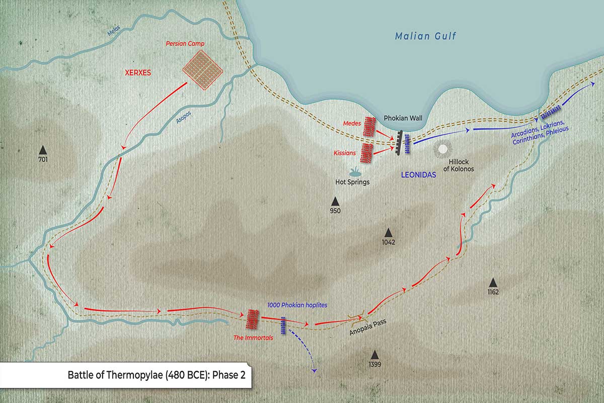
This map depicts the final phase of the battle of Thermopylae (480 BCE) when the Persians outflanked the Greek position.
Geography & Terrain
-
Narrow coastal corridor between mountains and sea—the choke point at Thermopylae.
-
Phokian Wall is marked across the road at the narrowest section (near the shoreline).
-
Hot Springs are indicated just west of the wall (origin of “Thermo-pylae,” “hot gates”).
-
Hillock of Kolonos, slightly east/south of the wall—final Greek rally point.
-
Rivers/streams: Melas (west) and Asopos (mid-map) flowing north.
-
Anopaia Pass is shown to the south—mountain route behind the Greek line.
-
Tracks/roads: Dotted lines trace routes along the coast and through the pass.
Forces & Positions
| Side | Units / Notes |
|---|---|
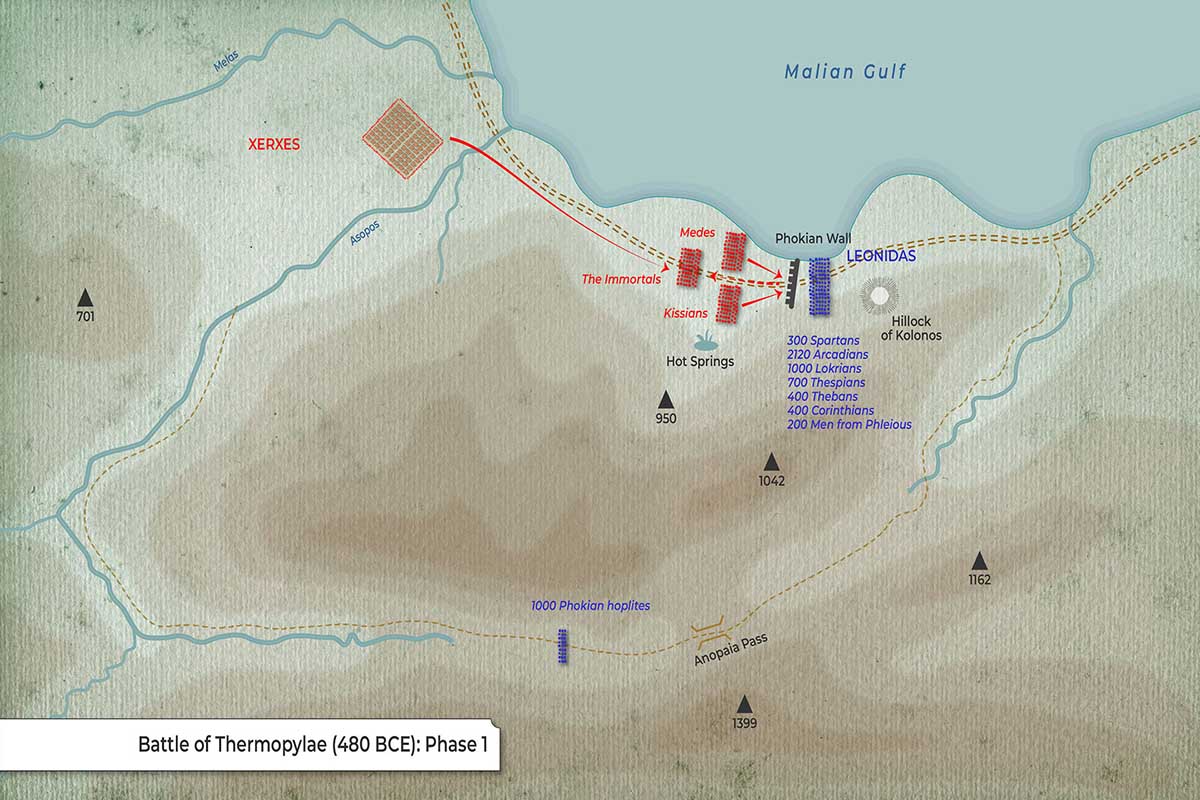
| Greeks | Leonidas with 300 Spartans, 700 Thespians, 400 Thebans (blue) |
| Persians | Medes (red block) |
| Persians | Kissians (red block) |
| Persians | The Immortals (red block) |
| Persians | Xerxes (label) & main host |
Movements & Arrows
-
Red arrows (Persian):
-
Advance along the coastal road toward the Phokian Wall (Medes/Kissians).
-
Outflanking approach of The Immortals coming in from the east/southeast, indicating they’ve used the Anopaia Pass to turn the Greek position.
-
-
Blue (Greek):
-
Fixed position of Leonidas’ contingent by the Hillock of Kolonos, signifying a last stand location after being outflanked.
-
Notable Labels & Features
-
“XERXES” along the main Persian axis of advance.
-
“Persian Camp” (red grid) set inland but near the coast to the west.
-
“Phokian Wall” shown as a barrier with small gate/openings across the road.
-
Topographic shading emphasizes the steep high ground hemming in the pass.
What the Phase Depicts
The decisive encirclement: Persians press head-on at the wall while the Immortals appear on the Greeks’ flank/rear after crossing the Anopaia Pass—forcing Leonidas to withdraw to the Hillock of Kolonos for a final stand within the narrowing ground by the sea.