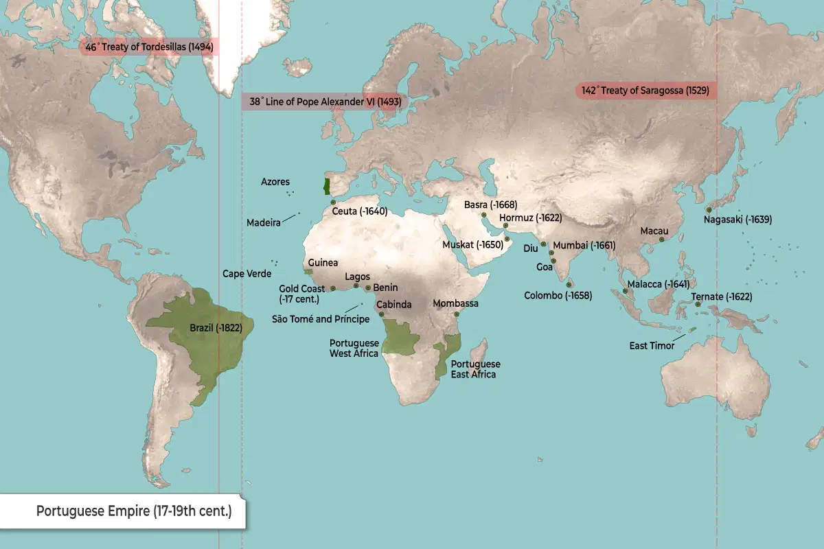
This map shows the Portuguese Empire during the 17th to 19th centuries.
The green areas mark Portugal’s colonial empire around the world.
- In Europe, Portugal itself is highlighted in green, along with its Atlantic islands like Madeira and the Azores.
- In South America, Portugal controlled Brazil (until 1822).
- In Africa, Portugal held colonies and trading posts such as Cape Verde, Guinea, São Tomé and Príncipe, Cabinda, Portuguese West Africa, Portuguese East Africa, and parts of the Gold Coast, Lagos, Benin, and Mombasa.
- In Asia and the Middle East, Portugal ruled areas including Goa, Diu, Mumbai (until 1661), Hormuz (until 1622), Muskat (until 1650), Basra (until 1668), Colombo in Sri Lanka (until 1658), Macau, Malacca (until 1641), Ternate (until 1622), East Timor, and had a brief presence in Nagasaki (until 1639).
The map also marks important historical boundaries set by the following treaties:
| 38° Line of Pope Alexander VI (1493) | Early division of new lands between Spain and Portugal. |
| 46° Treaty of Tordesillas (1494) | Moved the dividing line further west. |
| 142° Treaty of Saragossa (1529) | Set boundaries on the other side of the world in the Pacific. |