A few theorists believe the nine Azores islands are the remnants of Plato’s Atlantis. Books and maps from the 14th century also mention a group of islands in the approximate location of the Azores archipelago. However, officially, these volcanic islands were discovered by Portuguese sailors in the 15th century, who made the deserted islands their home. Due to its strategic location, the Azores became an important commercial port supplying ships traveling to Brazil, Africa, and India.
In this article, you will learn about the nine Azores islands and their history.
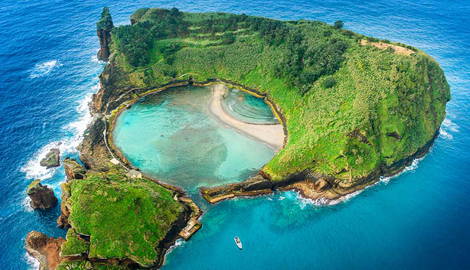
1. São Miguel
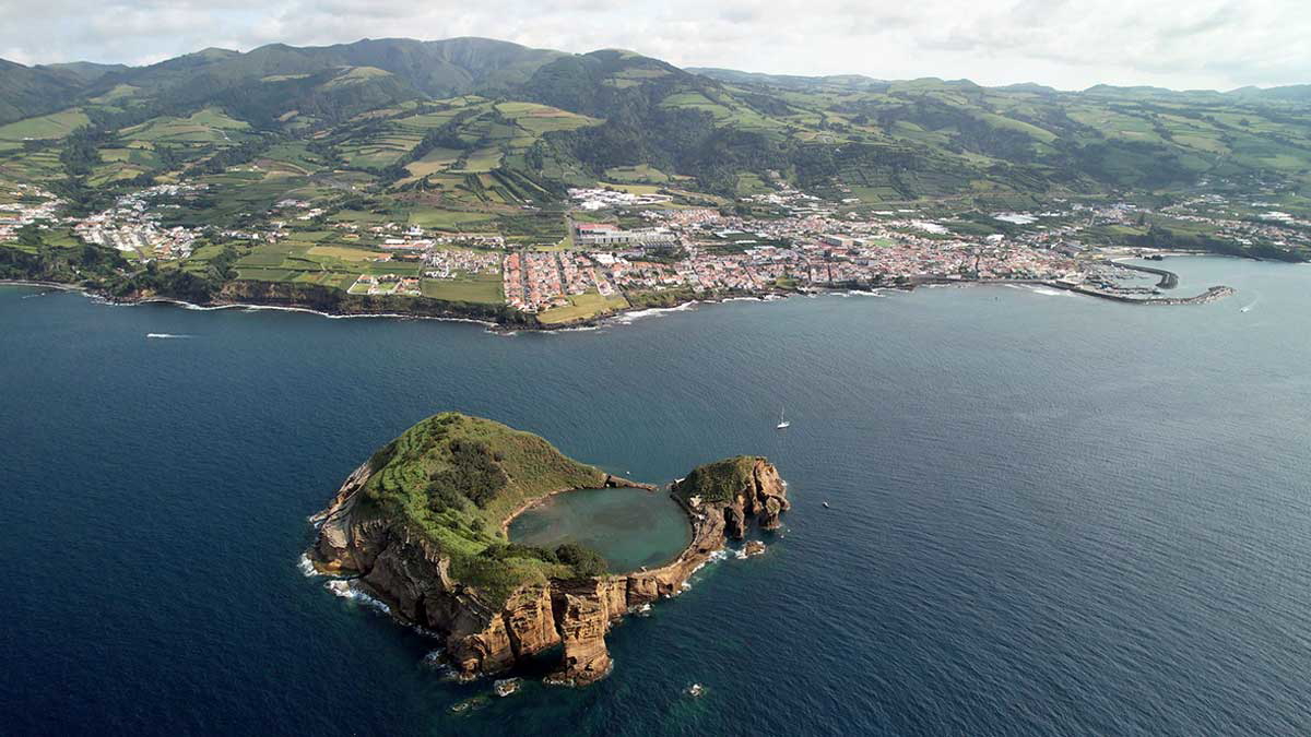
The largest Azores island was the second to be discovered, between 1427 and 1431. The first settlers arrived in 1440 from continental Portugal under the leadership of Gonçalo Velho Cabral. Shortly after, the Moors, Jews, French, and English followed in their footsteps. The fertile land and safe bays transformed São Miguel into the perfect trading post.
Vila Franca do Campo was the island’s capital until October 1522, when an earthquake demolished the city. In 1582, Ponta Delgada became the capital and it is now the largest city in São Miguel.
Until the end of the 16th century, São Miguel was attacked by privateers and occupied by Spanish troops due to the Azorian refusal to acknowledge Philip II of Spain as the new Portuguese king. Once independence was restored, São Miguel’s economy boomed thanks to commercial trade with Brazil. In the 19th century, exports to Great Britain allowed the construction of several monuments you can still visit today.
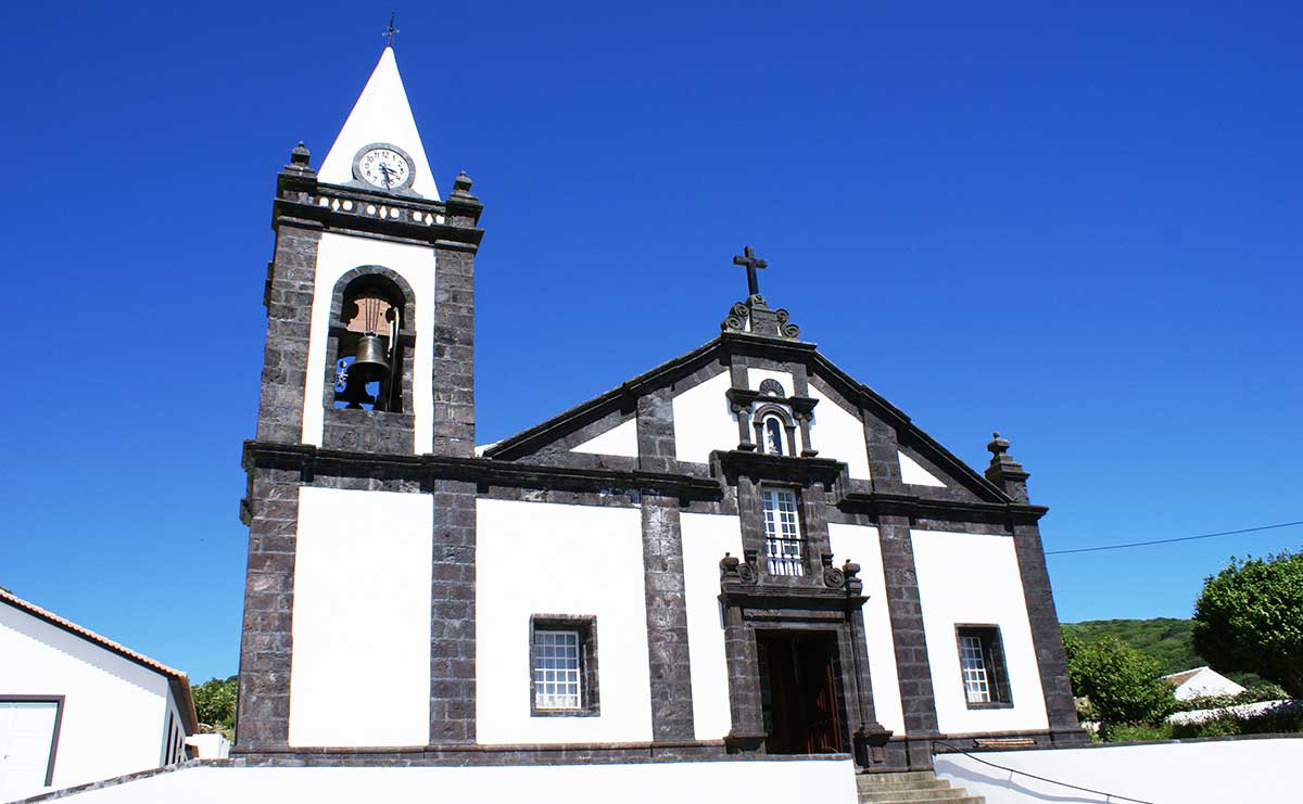
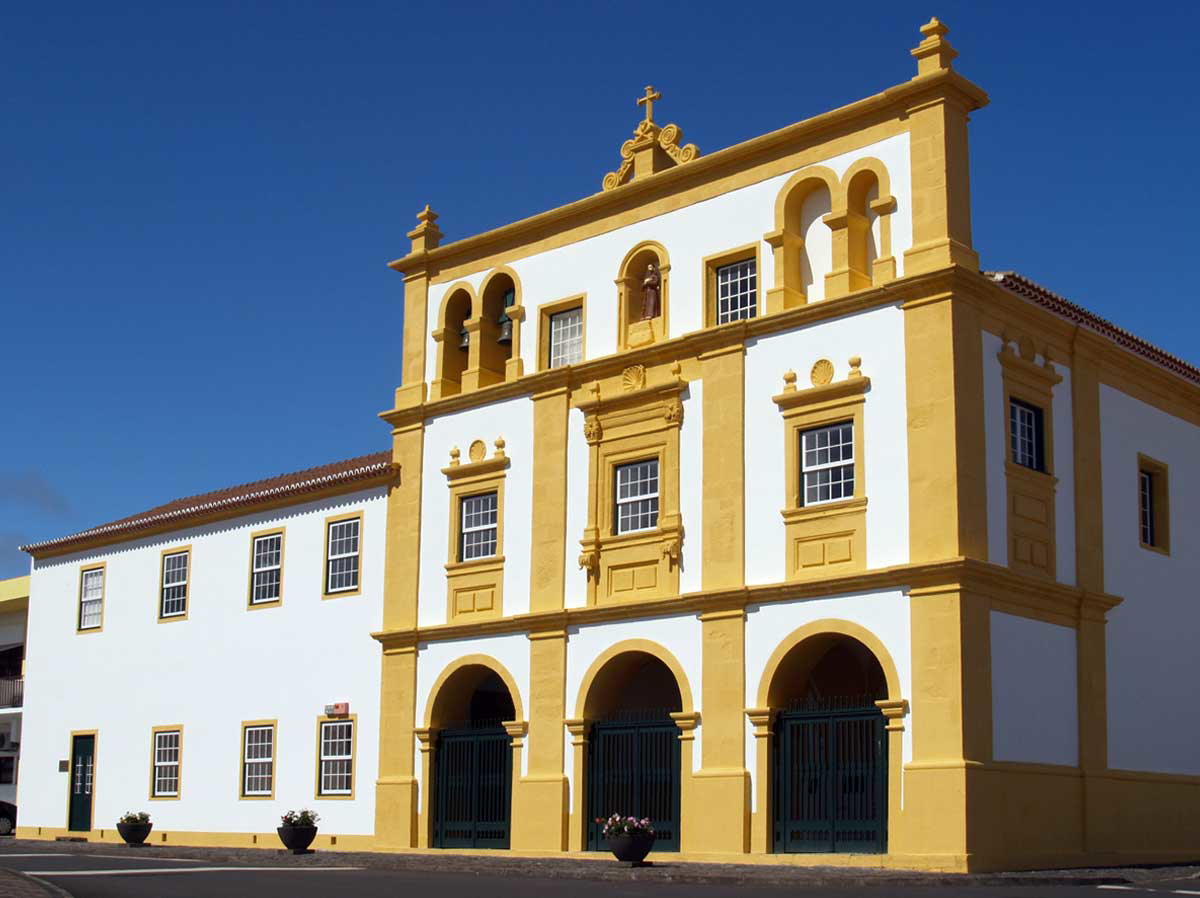
In Ponta Delgada, explore the Portas da Cidade arches, the Baroque Matriz de São Sebastião Church, and the Todos os Santos Church. If you are curious about military architecture, visit the 16th-century São Brás Fortress. Besides admiring its defensive walls, you can also explore the Military Museum.
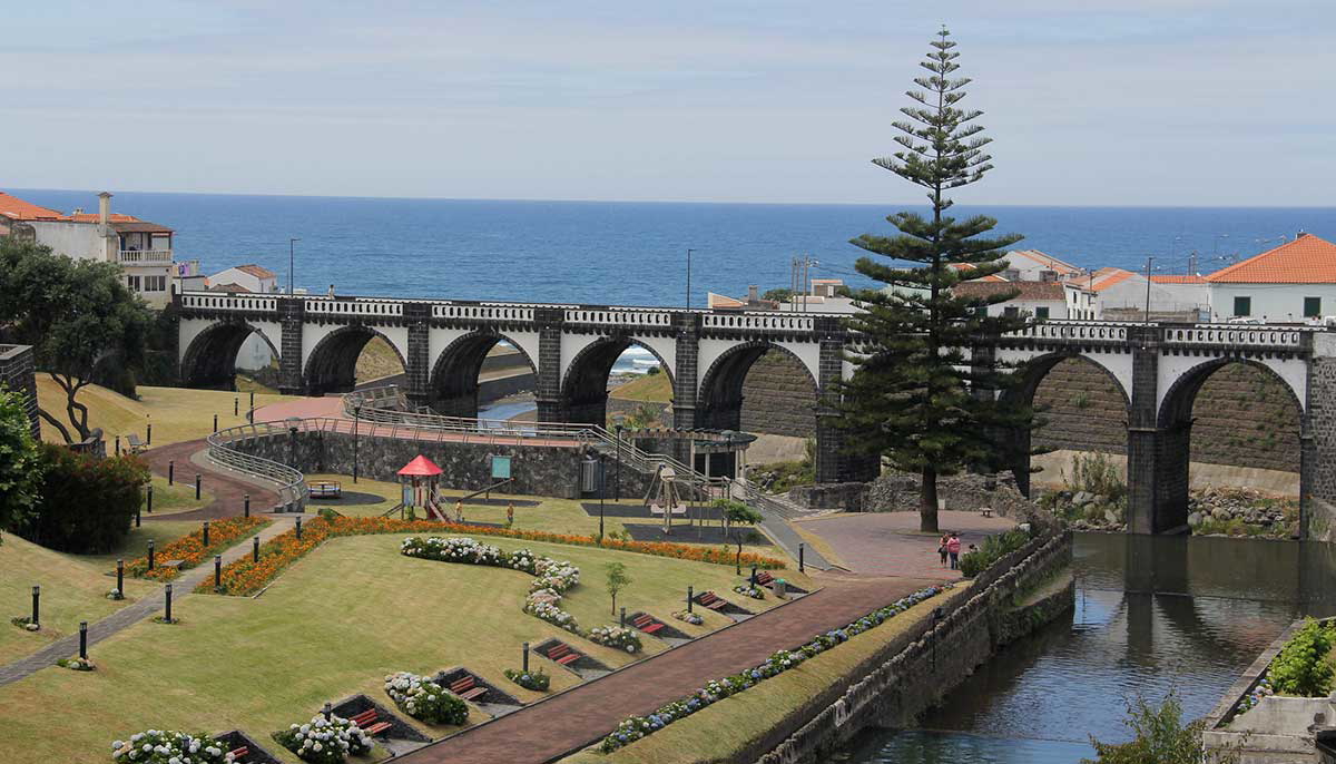
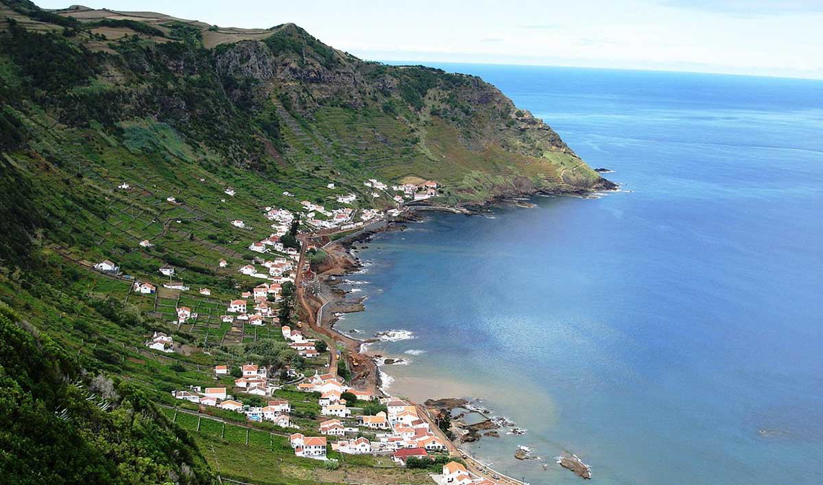
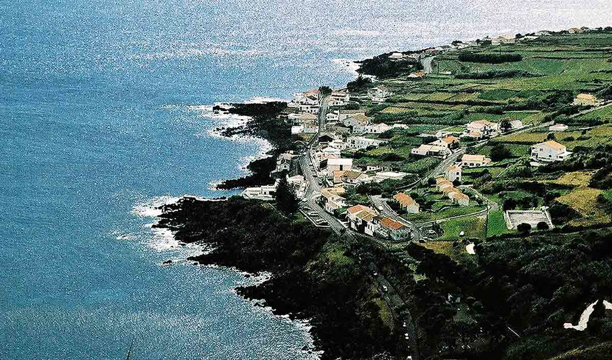
At Ribeira Grande, a short 20-minute drive from Ponta Delgada, you can admire the contrast between the white masonry and the stonework in several buildings, including the Nossa Senhora da Estrela church and the Ponte dos Oito Arcos bridge.
2. Santa Maria
Santa Maria is the most southeastern island in the Azores and it was the first to be discovered, in 1427. However, historians still debate whether Diogo de Silves or Gonçalo Velho Cabral was the first sailor to set foot on the island. Nevertheless, they agreed it was the latter who built the first settlement in Santa Maria after arriving at Praia dos Lobos in 1439.
The arrival of new families, mostly from the Algarve and Alentejo regions of mainland Portugal, helped develop Santa Maria Island. As a result, Vila do Porto was the first to be granted a charter.
In 1493, Christopher Columbus‘s ships docked at Santa Maria on their way back from the first voyage to discover America. Over the following centuries, more foreign ships arrived at Santa Maria.
In the 16th and 17th centuries, the island was often raided by English, French, Turkish, and Arab privateers. In 1616, the island fell under Moorish rule for one week. At that time, the population took refuge in the volcanic cave of Furna de Santana to escape the looting and torture.
In the 18th and 19th centuries, fruit, vegetable, livestock, and dairy small farms thrived. In the Second World War, the Americans helped build the island airport. At the time, they considered this a strategic location in submarine warfare.
To witness Santa Maria’s history, explore Vila do Porto’s traditional houses. Most of them still hold traces of ogival doors and Manueline windows. The Igreja Matriz da Nossa Senhora da Assunção dates back to the 15th century, and it is one of the oldest churches in the archipelago. Ath Fort of São Brás, you can still admire the cannons pointing out to sea as they did during pirate attacks centuries ago.
In the small town of Anjos, you can find a statue of Christopher Columbus, a tribute to the navigator who attended a mass celebrated in the Nossa Senhora dos Anjos Hermitage to thank our lady for saving him and his fleet from a life-threatening storm.
3. Terceira
Terceira in Portuguese means “third” and it was the third Azorean Island the Portuguese discovered. Originally called the Island of Jesus Christ, it was later renamed to Terceira.
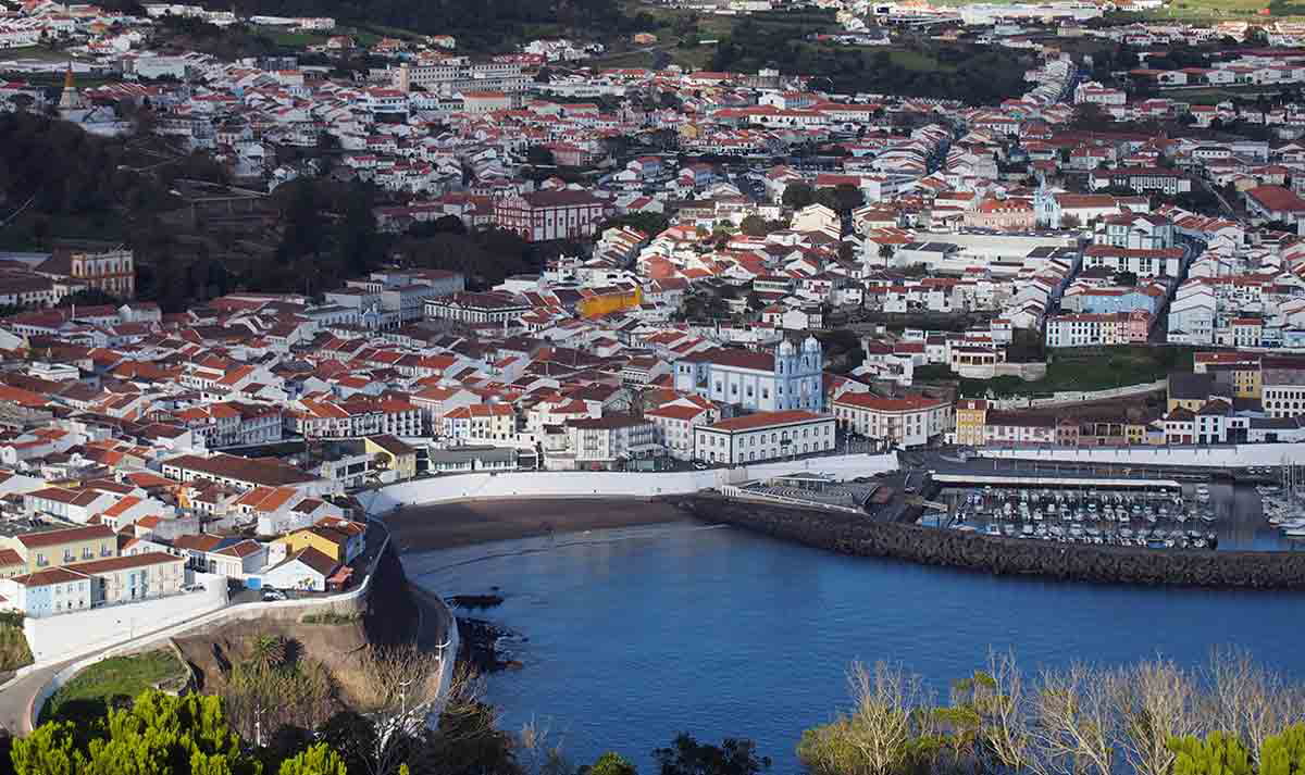
In 1449, Prince Henry the Navigator commissioned Jácome de Bruges to populate the island. However, the first settlers only arrived after 1470 to build their homes in Angra do Heroismo. Today, this small settlement is a UNESCO World Heritage Site.
Between the 15th and 16th centuries, Angra Bay was an important trading post both for regional trade and foreign ships sailing between Europe, America, and India. As a result, Angra do Heroismo became a political and economic mecca in the Azores, where spices and precious metals attracted English and Castilian privateers.
In the 16th century, when mainland Portugal was under Spanish rule, Castilian ships docked at Terceira, attacking the island and causing them to suffer significant losses.
In the 19th century, during the Liberal Wars, King Pedro IV used Terceira as a base to reconquer the Portuguese throne and Angra do Heroísmo became the capital of the kingdom.
During the Second World War, the British built Base das Lages, a military base, which they later handed over to the North American Air Force. Since then, Base das Lajes played an important role in the security of the North Atlantic, due to its strategic location.
The historical city center of Angra do Heroismo is the perfect location to explore this beautiful UNESCO World Heritage Site. Here, you can admire how the city evolved over the centuries around its bay. The colorful houses and monuments are like no other. Visit the Igreja da Misericórdia or Angra’s Cathedral to admire their unique designs. Other unique landmarks include the Alto da Memória Obelisque, São Sebastião Fortress, Duque da Terceira botanical garden, and Palácio dos Capitães Generais.
4. Graciosa
Although the year of its discovery is unknown, historians believe Graciosa was identified in 1427, along with other islands in the central group. Cattle released onto the island arrived before human occupation. Around 1470, the first families from mainland Portugal settled in two distinct areas: Santa Cruz and Praia.
The plains of fertile land attracted settlers who occupied the island’s interior from south to north. As a result, Santa Cruz developed and it was the first village in Graciosa to be granted a charter in 1486.
At the time, agriculture was the main economic activity and Angra do Heroismo, on Terceira Island, was a main trading port. Due to the abundance of barley, wheat, local brandy, and wine, pirates and privateers often raided Graciosa.
Over the centuries, droughts and natural disasters have led to an economic decline and the island’s impoverishment. Moreover, vine diseases affected Graciosa’s wine production. All these events contributed to mass emigration to the United States between the 1950s and the 1970s.
In an attempt to recover the wine-making tradition, in 1994 the Graciosa Demarcated Wine Region was created. Today, the island’s main economic activity is dairy and meat production.
Besides admiring the natural landscape in Graciosa, you can explore Nossa Senhora da Luz Church, Nossa Senhora de Guadalupe Church, Matriz de Santa Cruz Church, and the Hermitage of Nossa Senhora da Ajuda. All these landmarks were built over the ruins of primitive churches that did not survive the powerful destruction of natural disasters over the centuries.
5. São Jorge
The date of São Jorge’s discovery is unknown. However, due to its proximity to Terceira and Graciosa, historians believe it was most likely discovered at the same time as the other islands in the central group. The first settlers arrived in 1460 and developed several communities on the west and south coasts.
In the 15th century, São Jorge quickly developed, and Velas was the first town to be granted a charter. Despite the island’s abundance of wheat and high-quality pastures, São Jorge lacked safe harbors trading ships could use, resulting in the subdevelopment of the island’s economy.
Between the 16th and 19th centuries, consecutive volcanic eruptions and earthquakes led to an agricultural crisis and food shortage. To invert this trend, São Jorge followed the same agro-livestock model as the other islands, which meant producing wine, raising cattle, and growing wheat. By the end of the 19th century, whaling became the main economic activity here. Today, São Jorge inhabitants rely on the island’s pastures to produce the traditional São Jorge cheese.
Explore São Jorge’s heritage by visiting Igreja Matriz de São Jorge, a 17th-century church built over a small church from the 15th century. Although it was refurbished over the centuries, you can still admire the late Baroque and Rococo altarpiece with gilded wood carvings, given by King Sebastião. At the São Jorge Museum, you will find a collection of ethnographic artifacts that will allow you to understand the local culture and heritage.
6. Pico
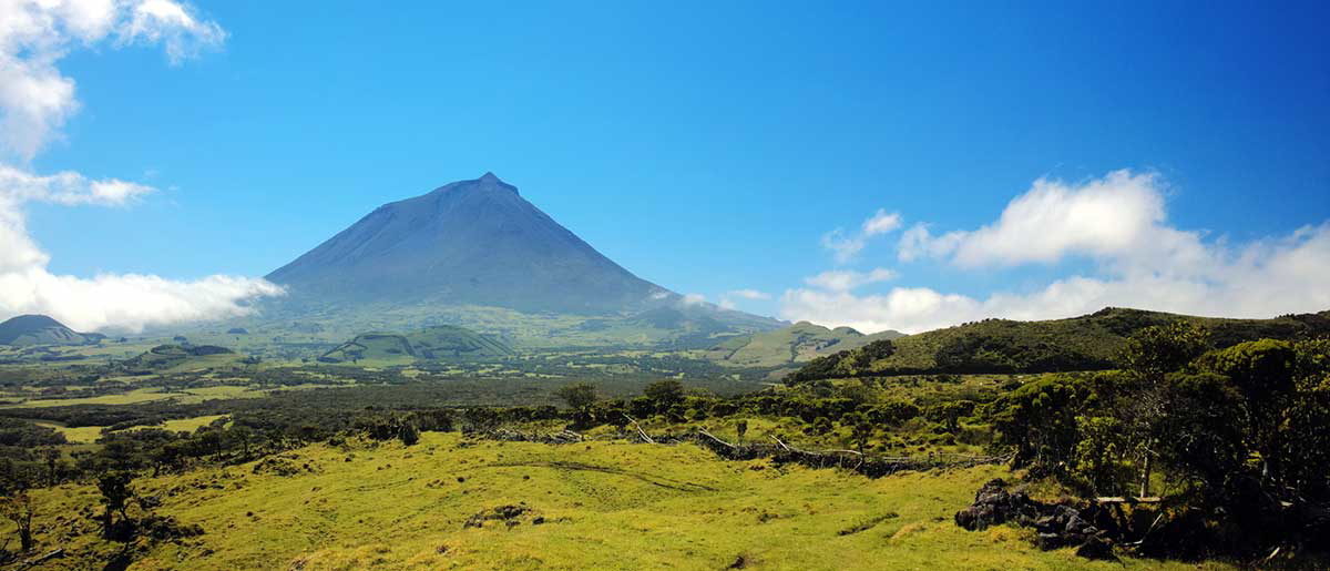
Pico Island was discovered at the same time as the other islands in the central group. Although it was originally called D. Dinis Island, it was renamed Pico as a tribute to Pico Mountain, the highest mountain in Portugal.
The first settlers arrived in 1480 from mainland Portugal and established in Lajes. During the settlement’s early days, the cultivation of wheat and pastel dye plants helped Pico Island’s economic development.
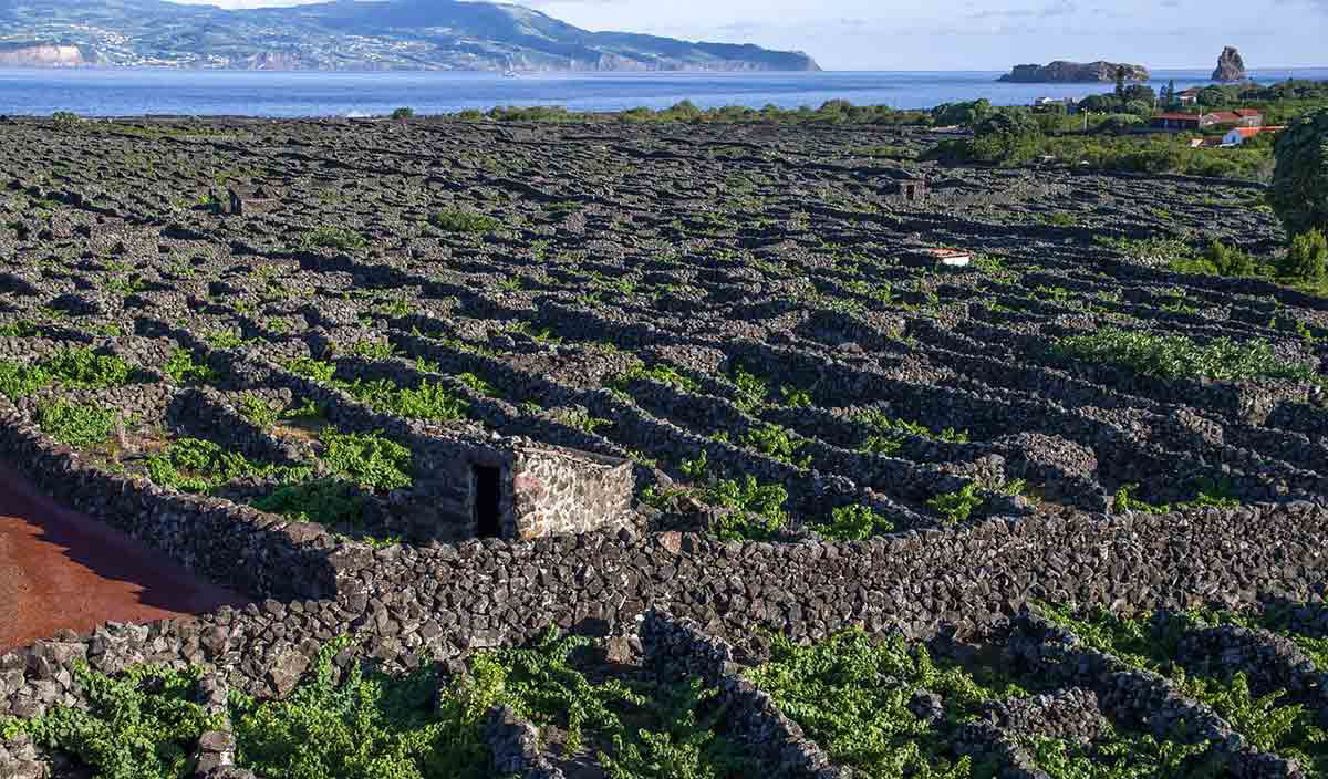
Over the years, the rich volcanic soils allowed the plantation of vineyards. The island’s unique climate and soil produced high-quality grapes. As a result, winemaking in Pico Island quickly launched the local economy with exports of Pico wine to Europe and America.
The uniqueness of Pico’s vineyards led UNESCO to classify them as a World Heritage Site in 2004. At Museu do Vinho, you can learn more about winemaking in Pico and how man transformed this inhospitable volcanic landscape to produce a one-of-a-kind wine.
As it happened in São Jorge, a series of volcanic eruptions and a disease that affected the vineyards led to a struggling economy. These events resulted in mass emigration. The ones that chose to stay, tried to recover old traditions and found their livelihood at sea.
Whaling attracted British and American fleets which used the island’s boats and harbors as recruiting stations, to get supplies and for the crew to rest. The activity of local and foreign whalers allowed sperm whale hunting to thrive until the end of the first half of the 20th century.
After years of decline and a growing awareness of whaling, the Portuguese government banned whale hunting in 1986. Cetaceans are now a protected species. At the Museu dos Baleeiros, you will have the chance to learn more about whaling and its relevance to Pico’s culture and traditions.
At Pico Island, you can also find the Ermida de São Pedro, a small and humble hermitage built in 1460, when the first settlers arrived. It is one of the oldest buildings in the archipelago.
7. Faial
Historians believe Faial was discovered shortly after Terceira Island. Its name was inspired by its beech tree forest (faias-da-terra, in Portuguese).
The first settlers from Flanders and mainland Portugal arrived at Faial in 1465. The fertile lands attracted Flemish noblemen who were granted a special permit from King Afonso V to colonize the island. Vale dos Flamengos was the first settlement, followed by Horta. The Flemish settled in Horta and introduced pastel cultivation. Along with wheat production, pastel was the main export for the next two centuries.
The island’s wealth attracted French and English privateers who left a trail of destruction and impoverishment. To make things worse, the volcanic eruption of 1672 devastated most of the north-west of the island.
In the 17th century, Horta became a relevant trading post for ships traveling between Europe and America. Its bay offered natural protection against unwanted visitors and served as the main port for the export of Pico wine. Throughout the 18th and 19th centuries, Horta preserved its reputation as a trading post, serving as a refueling stopover for steamers crossing the Atlantic and for whaling fleets.
By the end of the 19th century, exports declined due to a decrease in wine and grape production in Pico and Graciosa islands. Nevertheless, Faial kept its role as a middleman between Europe and America. In 1893, submarine telegraph cables moored in Horta allowed the transmission of information between the two continents. In the First and Second World Wars, Faial was the main stopover for German, British, French, and American hydroplanes.
At Faial, historical landmarks such as São Salvador Church, São Sebastião Fortress and Walls, Relógio Tower, and São Francisco Church will offer you a glimpse of the island’s past. However, to learn more about its culture and traditions explore the Museu da Horta, Centro de Interpretação do Vulcão dos Capelinhos, Museu do Scrimshaw, and Museu de Arte Sacra.
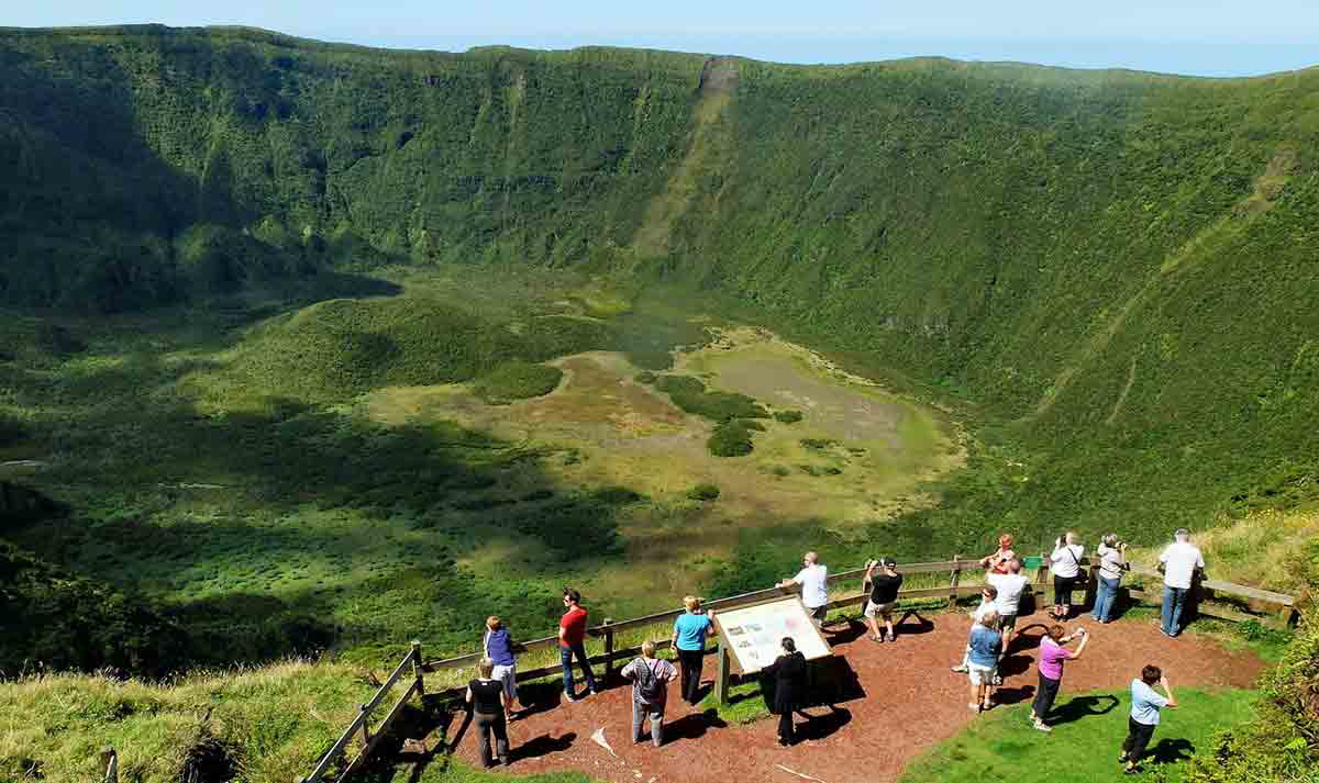
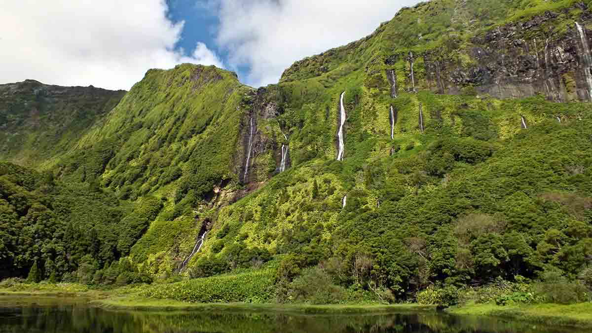
8. Flores
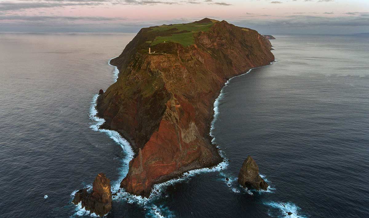
Flores, the westernmost point in Europe, was discovered in 1452.
In the following decades, several colonizers tried to settle in Flores. However, their efforts didn’t succeed due to the island’s geography and distance from the other islands. As a result, Flores was abandoned for many years until the arrival of the Fonseca family in 1508. Lajes das Flores and Santa Cruz das Flores were the first villages on the island to be granted a charter.
Over the following centuries, Flores’s economy thrived due to cereal and clothing production, sheep farming, and fishing. Due to its strategic location, Flores was a main stopover for ships traveling from the Pacific and Indian Oceans. Pirates and privateers knew the island’s potential for loot and they used to wait here for Spanish galleons on their way back from the Americas and for Portuguese ships traveling from India to Portugal.
From the second half of the 18th century onwards, Flores harbored English and North American whaling fleets, allowing them to get supplies and offering their crews much-needed rest. The construction of a new harbor in the 1970s allowed the island to become closer to the rest of the archipelago. Today, Flores’s economy revolves around nature tourism.
While exploring Flores, you can admire the local architecture of white-washed façades and basalt stonework. However, Nossa Senhora de Lourdes Church and Matriz de Nossa Senhora da Conceição Church, particularly stand out from the surrounding buildings due to their design and magnificence. At the Museu das Flores, you can admire traditional tools used in the island’s agriculture, as well as scrimshaw and sailing instruments.
9. Corvo
Corvo is the smallest and the most remote Azorean Island. It was discovered at the same time as Flores and due to its size, it didn’t attract colonizers. However, in the 16th century, Corvo was colonized by a group of Cape Verdian slaves sent by captain-donee Gonçalo de Sousa. Their mission was to cultivate the land and raise cattle.
The island’s strategic location allowed Corvo to avoid isolation. Since this was one of the westernmost points in the Portuguese maritime empire in the 16th century, the tiny island was a meeting point for Portuguese and Spanish fleets, from where they were escorted back to their home countries. As a result, Corvo was often raided by corsairs and pirates.
In the 18th and 19th centuries, American whalers arrived at Corvo and recruited the local population, which contributed to mass emigration to the United States and Canada. Over time, the population declined.
The construction of the island’s aerodrome in 1983 and regular flights to Flores, Faial, and Terceira, has allowed Corvo to become closer to the other Azorean islands.
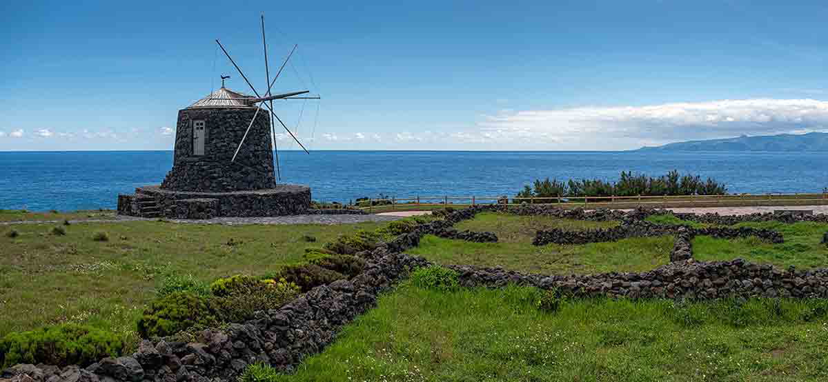
Vila do Corvo is the only village on the island. It is also the place where you can admire cobbled streets made of basalt. The Matriz da Nossa Senhora dos Milagres Church, built in 1674, holds a Flemish image of the patron saint. At the Altar dos Moinhos, several windmills overlook the ocean and testify to the importance of wheat and corn production for the island’s economy centuries ago.