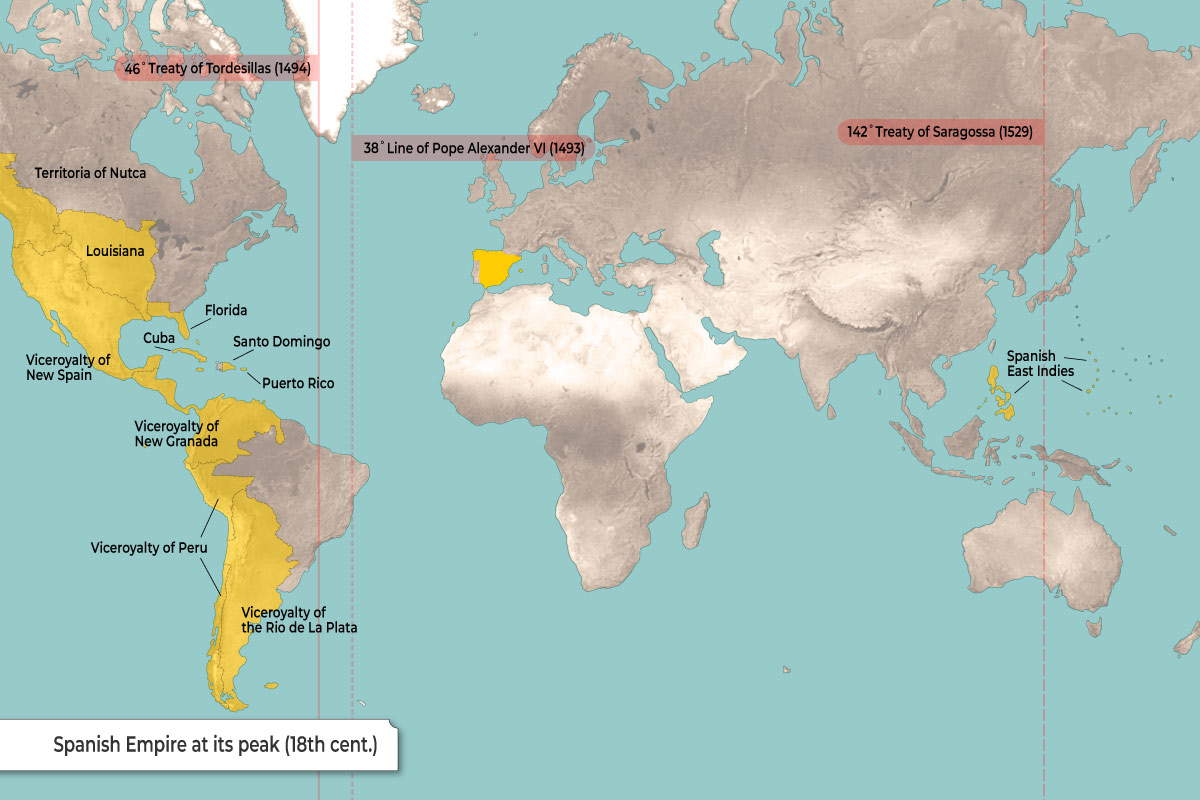
This map shows the Spanish Empire at its greatest territorial extent in the 18th century.
The yellow areas mark the territories controlled by Spain in Europe, the Americas, and the Pacific. In the Americas, Spain established a series of colonies including Florida, Cuba, Puerto Rico, Santo Domingo, Mexico (Viceroyalty of New Spain), much of Central and South America (Viceroyalties of New Granada, Peru, and the Río de la Plata), as well as Louisiana and the Pacific Northwest (Territoria of Nutca). The conquests took place after Christopher Columbus‘ voyages (1492-1504) and a period of conquest that resulted in the end of empires such as the Aztec and the Inca, as well as the deaths of millions who perished in the wars and European-brought diseases (such as smallpox). In Asia, Spain controlled the Philippines and other islands known as the Spanish East Indies.
The map also marks important historical boundaries set by the following treaties:
| 38° Line of Pope Alexander VI (1493) | Early division of new lands between Spain and Portugal. |
| 46° Treaty of Tordesillas (1494) | Moved the dividing line further west. |
| 142° Treaty of Saragossa (1529) | Set boundaries on the other side of the world in the Pacific. |


