


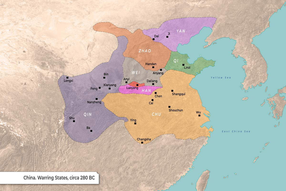
The territorial boundaries of China during the Warring States period, circa 280 BC.
-
The map displays seven major states occupying central and eastern China, bordered to the east by the Yellow Sea and East China Sea.
-
Each state is designated by a distinct color to show its regional dominance and borders.
-
Black square markers represent significant cities and settlements located within each state’s territory.
| State | Geographic Region | Marked Cities |
| Qin | West |
Longxi, Shu, Ba, Nanzheng, Feng, Bin, Xianyang
|
| Chu | South / Central-East |
Ying, Changsha, Cai, Chen, Shouchun, Shangqui, Wu
|
| Zhao | North Central |
Handan, Dai
|
| Wei | Central |
Anyi, Daliang, Anyang
|
| Han | Central |
Luoyang
|
| Yan | Northeast |
Ji
|
| Qi | East |
Linzi
|


