Less than 30 percent of the world’s surface is covered in land, yet this is still a massive amount of space that humans have sought to explore and exploit. Included in all this land are around 200,000 islands.
From the icy Arctic to the tropics, here are the five biggest islands in the world.
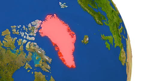
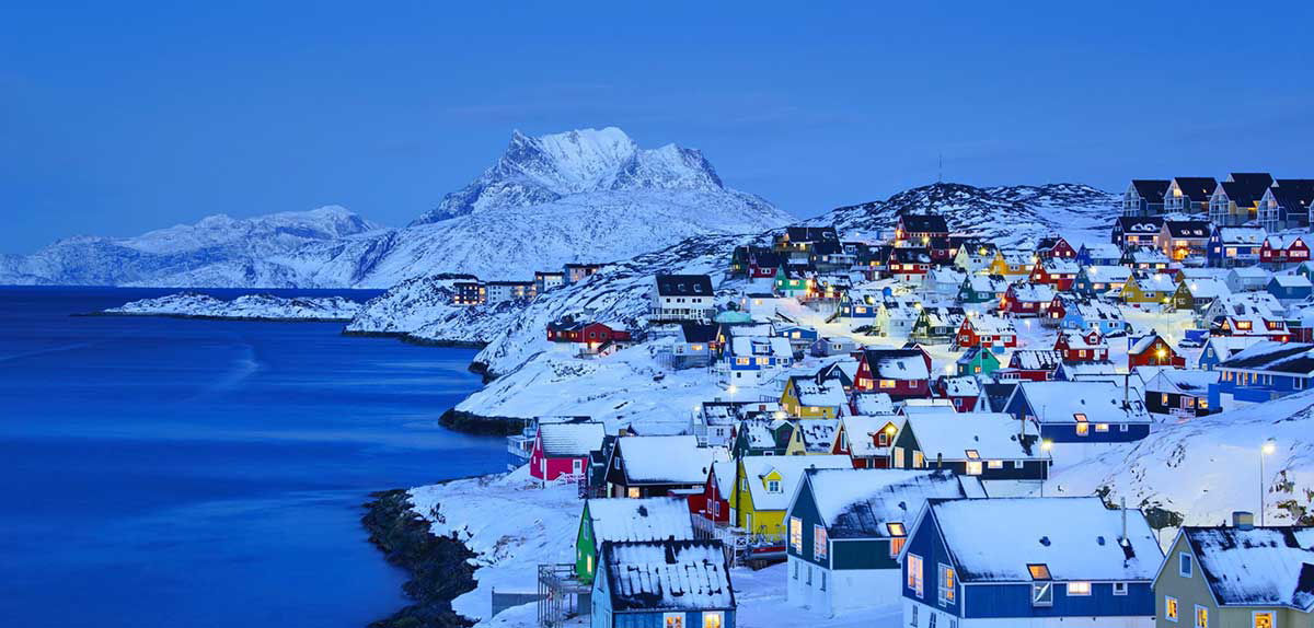
1. Greenland, the Biggest Island in the World
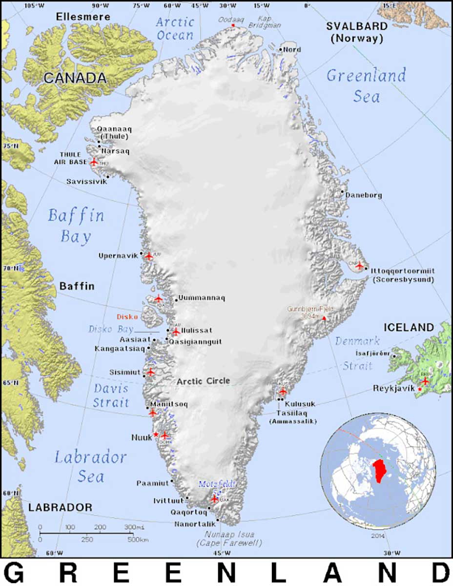
Located north of Canada and Iceland, and with much of its landmass in the Arctic Circle, Greenland, the largest island, is also an inhospitable and very cold place. Yet there are many people who live comfortably there, and who know how to survive the territory’s harsh climate.
Greenland is an autonomous territory administered by Denmark, and is 2,166,086 km2 (836,330 sq mi). For context, Alaska is 1,717,856 km2 (663,268 sq mi). Overlaid onto the contiguous United States from north to south, Greenland would stretch from Canada to Mexico.
Greenland was first inhabited around 4,500 years ago by the Saqqaq culture and the Independence culture, followed by the Greenlandic Dorset culture. There is academic debate over this cultural crossover, with the Greenlandic Dorset culture possibly representing two cultures: Independence II and Dorset. Recent studies show that Independence II evolved into the early Dorset culture.
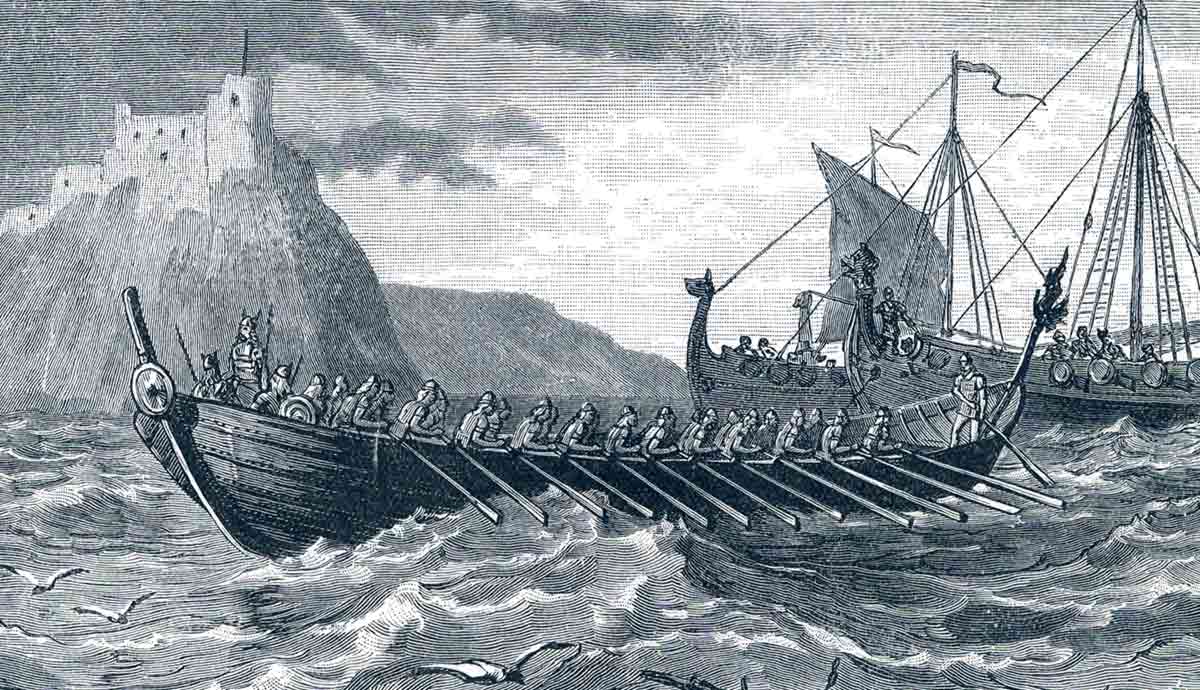
Nevertheless, the culture disappeared and Greenland was likely uninhabited until around 700 CE when the Late Dorset people occupied the northwestern part of the island. Around 980 CE, the Norse arrived and settled the southern tip of the island. After surviving there for 450 to 500 years, the Norse eventually abandoned the island, due to a number of suggested factors, such as climate, and environmental change, possible conflict with the Inuit, as well as loss of contact with their European counterparts.
Denmark did not know that the settlements had disappeared, and continued to claim sovereignty over the island. During the colonial era, Denmark-Norway sent missionaries to Greenland, and discovering a lack of Norse people, converted the native Inuit to Christianity, and kept their claim on the island. More colonies were developed along the coast, and trade was expanded.
During the Second World War, Denmark was occupied by Germany, and the United States took custody of Greenland until the end of the war when Denmark was liberated and the territory was handed back. Despite its close ties with Denmark, Greenland today is largely autonomous, and the territory is well-represented in Denmark’s parliament.
The population is mainly Inuit with around 90 percent of Greenlanders identifying as such. Minority ethnic groups include mostly Danish and other Nordic peoples.
2. New Guinea: Thick Forests and Mysterious Secrets
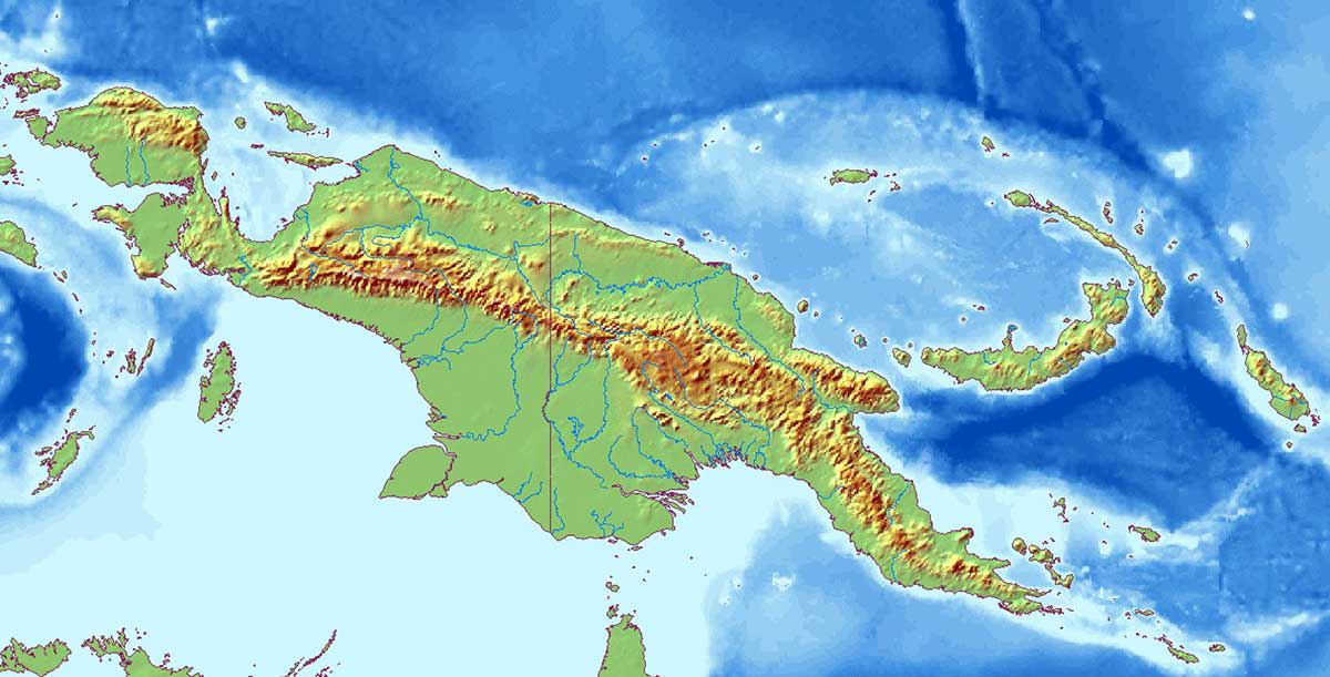
Located in Melanesia, New Guinea is the second largest island in the world, and is home to around 15 million people. The island is 785,753 km2 (303,381 sq mi) and is separated from Australia to the south by the Torres Strait.
People first arrived on the island around 60,000 years ago, and there is evidence that agriculture took place with irrigation systems around 10,000 years ago, making it one of the oldest centers of ancient agriculture.
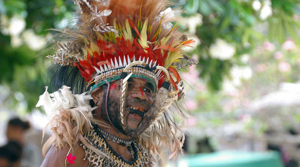
Austronesian people arrived on the island around 1,500 years ago, bringing with them new languages, cultural practices, and new technology, such as pottery to the island. Europeans first had contact with the island in the 16th century, but the island remained mostly unexplored until the late 19th century. The thick rainforests made exploration difficult and hid the local populations well. Many of the tribes that lived in New Guinea practiced cannibalism—a practice which mostly died out by the 1950s, although there have been later instances. The truth of whether the practice continues today is a subject of debate and one that demands a deeper understanding of the nuances and beliefs of the practice.
Today, the island is split between two nations. The eastern half forms the major landmass of Papua New Guinea, while the western half is part of Indonesia.
3. Borneo, an Island of Incredible Biodiversity
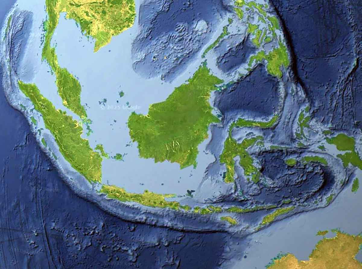
The third largest island in the world, the Southeast Asian island of Borneo covers 743,330 km2 (287,000 sq mi) and is divided among three sovereign states. To the north, the tiny nation of Brunei makes up around 1 percent of the island’s landmass, while the rest of the island is divided between the northern 25 percent belonging to Malaysia, and the southern 74 percent belonging to Indonesia.
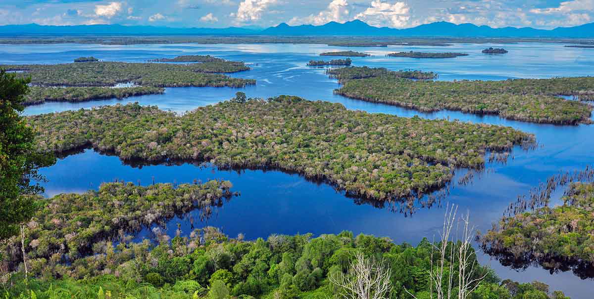
With the vast majority of the island covered in rainforests, Borneo is home to much floral and faunal diversity. Amongst the species of teak, oak, and conifer is the Rafflesia arnoldii, the “monster flower,” which is the largest species of flower in the world. Borneo’s animals include orangutans, gibbons, elephants, leopards, and proboscis monkeys. Sadly, however, the Sumatran rhino, which used to roam these rainforests, is close to extinction, and most of the total population of around 40 individuals lives on the neighboring island of Sumatra.
By contrast, the human population of Borneo currently stands at around 21.5 million. The biggest city is Samarinda, which is home to around 1 million people, and is located in Kalimantan, the Indonesian part of the island.
Human habitation of the island stretches back to around 65,000 years ago, and the island is home to some of the world’s oldest cave paintings. During the colonial period, the island was split between Dutch and British colonizers.
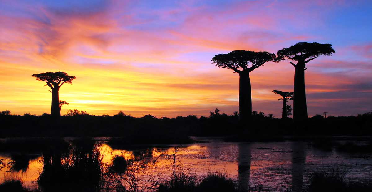
4. Madagascar
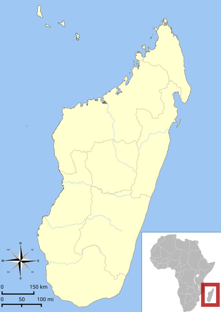
Located off the east coast of Africa, Madagascar is the world’s fourth-largest island and covers 587,040 square kilometres (226,660 sq mi). Madagascar is home to a unique, and fascinating array of diverse flora and fauna that evolved separately from mainland Africa as a result of the land mass splitting from the mainland of Africa (which was part of Gondwanaland) around 160 million years ago.
There are many unique animals on the island such as lemurs and fossas, as well as the unusual baobab trees that form a stereotypical image of the Madagascan landscape. The island was also home to the elephant bird, the largest species of bird to ever exist, which was hunted to extinction around 1,000 years ago.
The island also has a unique ethnic history that is quite different from the rest of Africa. Evidence shows its first inhabitants are thought to have been people who traveled from Southeast Asia as far back as 11,000 years ago. It is unknown whether Madagascar represented a permanent or temporary home for these people, but the island was certainly inhabited on a more permanent basis from around 2,000 to 2,500 years ago.
Research has shown that the Malagasy people were originally of Austronesian origin, with later migrations from other parts of the world adding to the ethnic and genetic diversity. The Malagasy people today are a vibrant mix of different cultures that are split into many ethnic groups.
Today, Madagascar is home to 32 million people, and struggles with issues of poverty and income disparity. Of great importance is the ecotourism industry, which not only supports the national economy, but is crucial for maintenance of Madagascar’s unique and beautiful biodiversity.
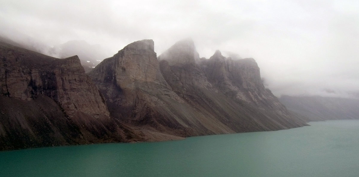
5. Baffin Island, a Harsh Place to Live
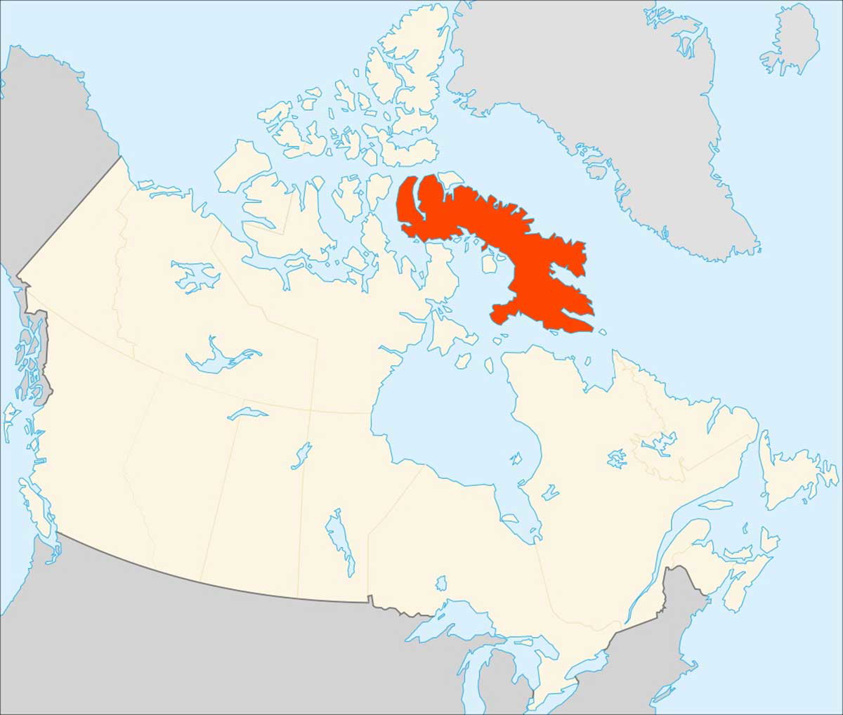
One of the many islands in the icy waters north of Canada, Baffin Island represents the world’s fifth-largest island. It is an inhospitable place offering very few opportunities for humans to survive.
Baffin Island covers an area of 507,451 km2 (195,928 sq mi), roughly the same size as Spain, and is located north of Hudson Bay between Canada and Greenland. Despite its harsh wilderness, Baffin Island has been inhabited for more than 3,000 years. The first inhabitants were the Paleo-Eskimo, Pre-Dorset and Dorset people, followed by the Thule people who were the ancestors of the modern Inuit people who live on Baffin Island today.
The first Europeans to arrive on Baffin Island were Norsemen. Around 985 to 986 CE Bjarni Herjólfsson and his crew were sailing from Iceland to Greenland when they lost their way and ended up on the shores of Baffin Island. What happened next is a subject of great debate. There is evidence to suggest that the Norse established a trading post on the island, but the evidence is far from conclusive, and L’Anse aux Meadows in Newfoundland remains the only truly confirmed site so far of Norse inhabitation on the North American continent (excluding Greenland).
Subsequent European exploration occurred in the 16th century when Englishman Martin Frobisher made landfall. The Island, however, ended up being named after another Englishman, William Baffin, who encountered the island while searching for the Northwest Passage.
Today, Baffin Island forms part of the vast Canadian territory of Nunavut and is sparsely populated, except for a few small settlements along the fjord-laden coastline. The biggest of these settlements is Iqaluit, which is home to around 7,500 people and is the capital of the entire Nunavut Territory.
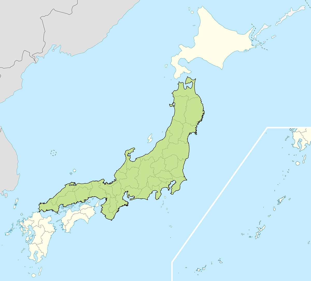
There are many other islands that stand out when one looks at a world map. Sumatra, directly to the west of Borneo, is the sixth-largest island in the world, and Honshu, the largest of the Japanese islands, is the seventh. Behind them is Victoria Island to the north of Canada, and then Great Britain, which includes England, Scotland, and Wales.