Hidden beneath thick jungle canopies, vast lost cities are beginning to reappear. With laser surveys now mapping vast areas from the sky, archaeologists are uncovering large pre-Columbian settlements across Central America and the Amazon. Places once dismissed as remote outposts are now understood as part of intricate, urban networks. Roads, temples, reservoirs, and farmlands are surfacing in the data. From Guatemala to Honduras and Belize, the rainforest is revealing the full scale of ancient civilization, pushing us to rethink what we thought we knew.
Mapping the Past With New Eyes

In 2023, researchers scanning the Upper Amazon in Ecuador found an expansive urban landscape hidden below the trees. Using LiDAR (short for Light Detection and Ranging), they recorded nearly 7,000 buildings, canals, roads, and ceremonial platforms, many of which date back over 2,500 years, about the same time as Ancient Rome.
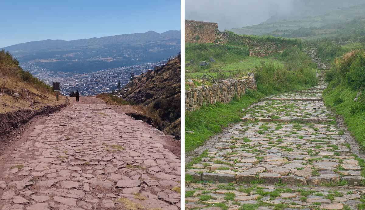
But the shift began even earlier. In Guatemala’s Petén region, similar scans uncovered more than 60,000 previously undocumented Maya structures, ranging from house mounds to monumental centers. El Mirador, once believed to be an isolated ceremonial site, now appears to have been part of a broader urban network connected by long, straight causeways.

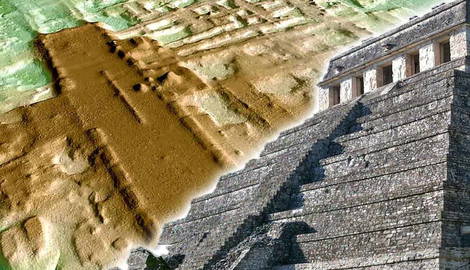
LiDAR works by sending pulses of light from aircraft to the ground and measuring how long they take to bounce back. Using software, researchers strip away the vegetation and reveal the shape of the land below—terraces, structures, and roadways that had been invisible.
This method has transformed archaeology, especially in the tropics where wilderness is often impenetrable. Across Guatemala, Belize, Honduras, and Mexico, entire regions that had resisted mapping due to thick vegetation or rugged terrain are now being documented in detail. These surveys are giving archaeologists a far more complete picture of what once shaped the region.
Some of these cities supported populations in the tens or hundreds of thousands. They included temple complexes, housing districts, engineered farmland, and water systems built with care. What we’re seeing now is a fuller picture—ancient Mesoamerica not as a scattering of jungle ruins, but as a series of complex, connected civilizations.
“LiDAR is revolutionizing archaeology the way the Hubble Space Telescope revolutionized astronomy,” says Francisco Estrada-Belli, a Tulane archaeologist involved in mapping Guatemala’s Petén. “We’ll need 100 years to go through all the data and really understand what we’re seeing.”
One discovery that captures the scale of what lies beneath the jungle is La Danta, a pyramid hidden in the far north of Guatemala…
La Danta: The Giant Hidden in the Jungle

Deep in Guatemala’s Mirador Basin sits one of the largest pyramids on Earth. The La Danta complex at El Mirador rises around 72 meters (236 feet) and covers such a broad base that, by volume, it surpasses even the Great Pyramid of Giza. Built more than 2,000 years ago, it was part of a vast Preclassical Maya city long swallowed by jungle. Today, reaching La Danta means a multi-day trek or a chartered helicopter.
Lost Cities in Central America You Can Visit Today
Thankfully, not all of these rediscovered sites are tucked away in the jungle. Some have been open to visitors for years and stand among the most remarkable ancient cities in Central America. With new discoveries unfolding, these Maya ruins now offer a much more detailed understanding of the civilizations that built them.
Tikal, Guatemala

If you only visit one Maya site in Central America, make it Tikal. This place was a true powerhouse of the ancient world, once home to around 60,000 people. You can wander through massive plazas, climb steep temple steps, and explore ruins where jungle trees still wrap around stone. Head up Temple IV for sunrise and you’ll see the tops of pyramids poking through the mist. The jaw-dropping aspect is that what you see today is but a fraction of it. Lasers have mapped a much bigger city stretching far beyond the visible ruins, with roads, homes, and farmland hidden beneath the forest.
Caracol, Belize

Tucked inside Belize’s largest forest reserve, Caracol feels like a proper lost city. You’ll need a bumpy ride to get there, but once you arrive, it’s well worth the effort. This was one of the biggest Maya cities ever found, larger in size than modern-day Belize City. At its peak, over 100,000 people lived here. You can walk among massive stone temples, ceremonial plazas, and carved monuments that tell stories of kings, battles, and rivalries. Laser scans have shown that the jungle around you once held farms, reservoirs, and even highways connecting distant villages to the city at its heart.
Copán, Honduras

Copán is smaller than some other sites, but what it lacks in size, it makes up for in detail. This city was famous for its art and its intellect. You’ll find some of the best stone carvings in the Maya world here, especially along the Hieroglyphic Stairway, which holds the longest known Maya text carved in stone. The setting is beautiful too, with ruins set in a green valley full of birds and old trees. Thanks to new scans, archaeologists now know that what looks like a ceremonial center was actually part of a much larger, planned city all around it.
Palenque, Mexico

If you’re heading into southern Mexico, Palenque is one of the most rewarding Maya sites to explore. The city sits at the edge of the rainforest, with temples and palaces rising above thick jungle. It is known for its detailed carvings and for the tomb of King Pakal, found deep inside the Temple of the Inscriptions. You can walk through palace corridors, climb pyramids, and hear howler monkeys in the trees above. New surveys have shown the surrounding hills once held homes, farmland, and terraces, hinting that much of Palenque’s population lived beyond what’s visible in the core today.
Ciudad Blanca: Between Myth and Map

For centuries, people in Honduras spoke of a lost city hidden in the Mosquitia rainforest. Known as Ciudad Blanca or the City of the Monkey God, many considered it more legend than fact. That changed in 2012, when LiDAR scans exposed rectangular plazas, pyramid-like mounds, and ancient earthworks in the area where stories had long placed them.
The site remains off-limits to tourists and is still under research, but its discovery raised an important point: local Indigenous knowledge had kept the memory of this place alive, and technology is now merely catching up.
What These Cities Are Telling Us and the Work Ahead

These discoveries are filling in the blanks. What once looked like isolated ruins now appears to be part of a larger story, of important and bustling cities built with purpose, scale, and connection. Some supported vast populations, and their decline seems to have come gradually, shaped by drought, climate change, or shifting trade routes.
What’s especially important about the new discoveries is how they are validating what many Indigenous communities have always known. These forests were never empty and held memory, movement, and life for millennia.
Scanning continues across the region, with new projects underway in Chiapas, the Mirador Basin, and western Honduras. Many of the newly documented sites are still being studied or protected, but the hope is that one day, more will be open to explore, guided by Indigenous community involvement and ethical conservation.
For now, special places like Tikal, Caracol, Copán, and Palenque let you step into a history that’s still being told, with each scan bringing these mystical cities into even sharper focus. With only a fraction of the forest surveyed, many experts believe the most significant discoveries are yet to come. Entire city systems may still lie beneath the canopy, waiting to reshape the map, and all we thought we knew of the ancient Americas.