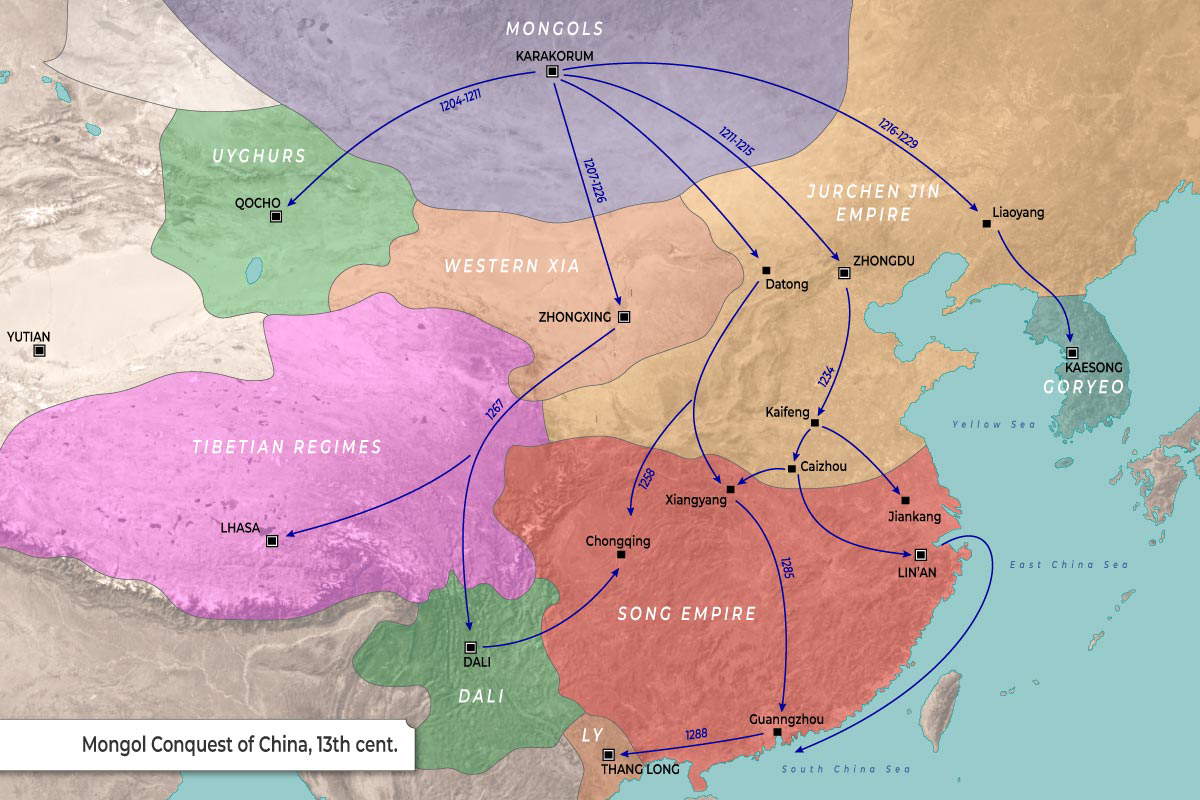
The map illustrates the military campaigns and territorial landscape of the Mongol Conquest of China during the 13th century.
-
The map uses distinct colors to delineate the various regional empires and regimes present before and during the , such as the Song Empire, Jurchen Jin Empire, and Western Xia.
-
Blue arrows trace the directional routes of the Mongol invasions originating from their northern base at Karakorum, spanning outwards across East and Southeast Asia.
-
Dates are associated with these campaign arrows to mark the chronological timeline of the regional invasions (e.g., 1204-1211, 1234, 1258).
-
Significant cities are marked with black squares, while primary capital cities are distinguished by a square containing a white center.
| Empire / Region | Campaign Dates (per arrows) | Marked Cities |
| Mongols |
Base Region
|
Karakorum
|
| Uyghurs |
1204–1211
|
Qocho
|
| Western Xia |
1207–1226
|
Zhongxing
|
| Jurchen Jin Empire |
1211–1215, 1234
|
Zhongdu, Datong, Liaoyang, Kaifeng, Caizhou
|
| Goryeo |
1216–1229 (route extends here)
|
Kaesong
|
| Song Empire |
1258, 1285
|
Lin’an, Xiangyang, Jiankang, Chongqing, Guanggzhou
|
| Tibetian Regimes |
1267
|
Lhasa, Yutian (far west)
|
| Dali |
N/A (on 1258 southern route)
|
Dali
|
| Ly |
1288
|
Thang Long
|