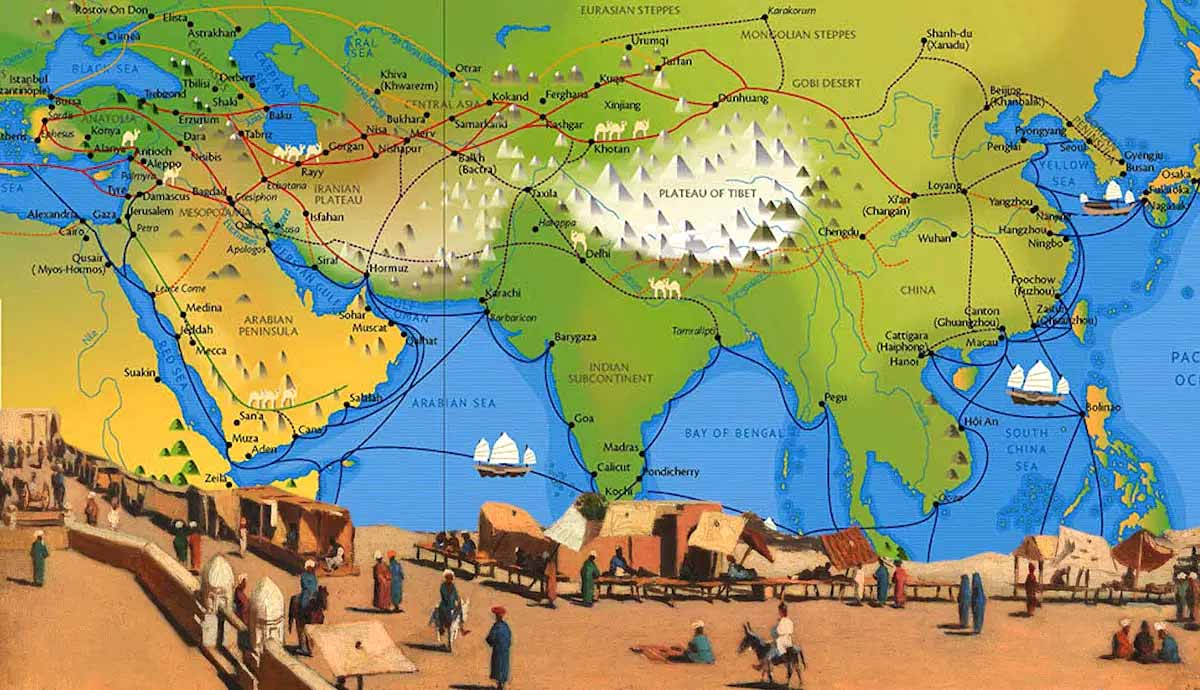
This comprehensive map illustrates the Silk Road, the most influential network of trade routes in human history. Spanning from the 2nd Century BCE to the 15th Century CE, these routes served as the primary artery for the exchange of goods, religions, and ideas between the East and the West.
From the imperial capital of Chang’an (modern-day Xi’an) to the bustling markets of Constantinople and Alexandria, this map traces the perilous paths through the Gobi Desert, the Taklamakan, and the soaring peaks of the Himalayas and Hindu Kush.
| Region | Major Trade Cities | Geographic Challenges |
| East Asia | Chang’an, Dunhuang, Kashgar | Gobi Desert, Mu Us Desert |
| Central Asia | Samarkand, Bukhara, Merv | Tian Shan Mts, Pamirs |
| South Asia | Taxila, Varanasi, Tamalipta | Himalayas, Thar Desert |
| Middle East | Baghdad, Palmyra, Damascus | Zagros Mts, Lut Desert |
| The West | Constantinople, Antioch, Tyre | Caucasus Mts, Mediterranean Sea |