The dawn of the 15th century marked the end of the Middle Ages and the beginning of the Age of Exploration. In this century, the Portuguese would expand their reach beyond Europe and North Africa thanks to explorers like Bartolomeu Dias and Vasco da Gama. A great trade in spices and other valuable goods was already thriving across the Indian Ocean. However, there was no canal to link the Atlantic to the Indian Ocean as there is today. If the Portuguese were to reach the ports of the East by sea, they would need to navigate the unexplored African coastline.
Bartolomeu Dias & Portuguese Exploration in the North Atlantic
In 1394, Henry the Navigator, a Portuguese prince, was born in the historic city of Porto. The son of King John I, he was a driving force behind the Age of Exploration and sponsored several maritime expeditions to the south and west, taking a 20% cut of the profits on their return.
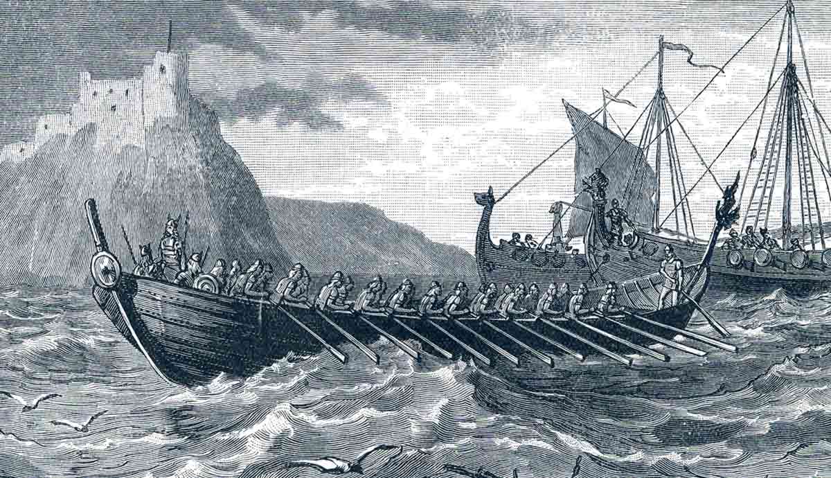
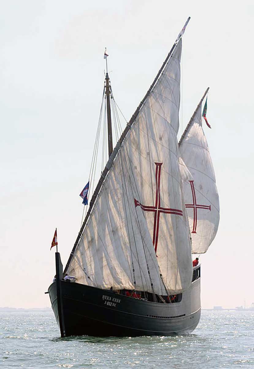
During his lifetime, Portuguese sailors would explore much of Africa’s northwest coast using their caravels, the sailing vessels of choice at the time. These ships were ideal for coastal exploration, as they were fast, highly maneuverable, and designed to navigate shallow coastal waters. Their lateen sails also made it possible to progress more efficiently against the wind.
By the middle of the century, the Portuguese had discovered several Islands in the North Atlantic, including Madeira and the Azores. The acquisition of these islands was instrumental in the growth of the Portuguese Empire, as they were ideal for the production of valuable cane sugar. This period also marked the birth of the Portuguese slave trade, which saw thousands of enslaved Africans sent to Europe by the mid-16th century. However, this ambitious nation had its sights set on more distant opportunities.
Bartolomeu Dias
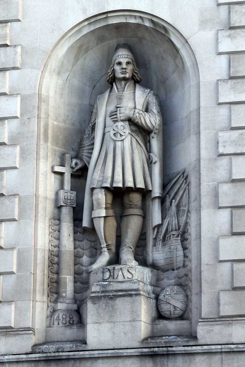
Bartolomeu Dias was born in 1450 in the Faro District of southern Portugal. He was a man destined to reach a dramatic milestone in European maritime exploration. We know little of his childhood, but by his thirties, he had become a knight of King John (João) II. The king, who ascended to the throne in 1481, had two main objectives: to capitalize on the spice trade and make contact with Prester John, the mythical Christian king.
Dias was selected to head an ambitious expedition beyond the Atlantic. This was not his first journey along the west coast of Africa, but it was to be his greatest. The goal was to round Africa’s southern tip, in present-day South Africa, and head north across the hitherto unexplored Indian Ocean. Much of what we know of this voyage comes from the writings of João de Barros, penned decades later in the mid-1500s.
The Voyage of Bartolomeu Dias
Dias set sail in August 1487 with a fleet of three ships. Two of them, the São Cristovão and the São Pantaleão, were caravels, and the third was a supply ship. Their first stop was at the Portuguese castle at Elmina, Ghana, to replenish supplies. They then traveled more than 2,000 miles south to Namibia, where they left their supply ship.
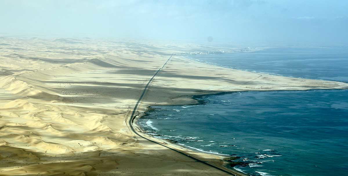
The caravels continued south to the vicinity of the Gariep River mouth—the landmark that forms the boundary between present-day Namibia and South Africa. Here, on Africa’s southwest coast, the dominant winds blow from the southeast and southwest. These headwinds forced the fleet to change course, heading not south in their intended direction but rather southwest into the open Atlantic.
After about two weeks, they reached a latitude where the wind direction changed to a westerly one, allowing them to head back toward the shore. However, they had already passed the southwestern tip of Africa at Cape Point, and thus, they failed to reach land. One can only imagine the anxiety those sailors must have felt over the month or so they spent out of sight of the shore.
Adjusting their heading to the northeast would bring them back to land on February 3, having missed much of South Africa’s west and southwest coast. The land they found was a stark contrast to the inhospitable landscapes they had last seen in Namibia. At last, the Portuguese had rounded the tip of Africa.
Terra Firma
Mossel Bay is a sheltered bay on the Indian Ocean, approximately 200 miles due east of Africa’s southwestern tip at the Cape of Good Hope and over 100 miles from the southernmost point of Africa at Cape Agulhas. Several small rivers reach the sea in the vicinity of Mossel Bay, and the surrounding areas are relatively lush and green, with deep forests and towering mountains just inland.
Here, Bartolomeu Dias and his crew took stocks of fresh water and traded with the local Khoikhoi herdsman for livestock. Sadly, this first interaction with indigenous South Africans would turn violent. Despite the Portuguese king’s orders to remain peaceful, Dias would shoot and kill a man with a crossbow after a confrontation over the crew’s use of water resulted in aggression from the local people. After leaving Mossel Bay, the sailors followed the imposing, rocky shore east until the coast veered north.
They continued along the coast for a further six weeks until the crew insisted on turning back. It was mid-March, and the expedition had taken them as far as the mouth of the Great Fish River, or Rio Infante, as they had called it. One of Bartolomeu Dias’ objectives was to place physical markers called padrões at key points along the coast to leave a record of their progress and proclaim the areas as both Portuguese and Christian. These limestone pillars were roughly seven feet tall and topped with a cross. They also included the date, the name of the explorer who placed them, and the king’s name.
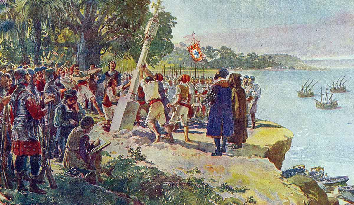
Bartolomeu Dias would erect three padrões on this voyage, the first of which was left at Kwaaihoek, near present-day Port Elizabeth, to mark their progress. The monument to his historic journey was located in 1938 by Professor Eric Axelson. It was reconstructed from thousands of fragments and is preserved at the University of the Witwatersrand in Johannesburg, South Africa.
Bartolomeu Dias Returns to Portugal
Bartolomeu Dias’ return trip would follow the coast, taking in the southwestern coastline around the Cape of Good Hope, where another padrão was erected. The crew stopped again in Luderitz, Namibia, to erect their last padrão and collect their supply ship. Sadly, by this time, just three of the nine men who stayed with the ship had survived. The rest were killed in skirmishes with locals.
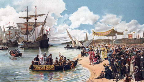
Dias and crew arrived back in Portugal in December 1488. They had not only reached new ground and left the padrões to prove it, but they had also shown that it was possible to access the Indian Ocean by sea. Crucially, they had also deciphered the wind patterns that made sailing possible in the region.
Despite Dias’ and his crew’s achievement, the Portuguese had still not made the journey from Europe to India by ship. King John II would not launch another attempt before his death in 1495, but his successor, King Manuel, would. The new king inherited the desire to establish access to the lucrative spice trade and set to work arranging a new expedition.
Vasco da Gama Rounds the Cape
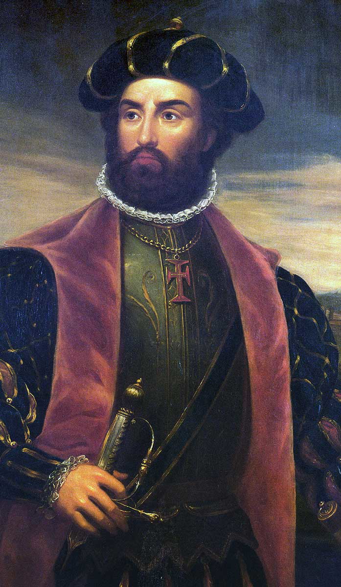
The leader of this voyage would be Vasco da Gama, who was born around 1460 in Sines on the southwest coast of Portugal. At the time of his voyage, the Portuguese had already seen most of the African coastline. All that remained was the approximately 1,200-mile stretch between the Great Fish River, where Dias turned back, and Sofala in Mozambique. This port on the east coast had been visited from the north by the explorer and spy Pêro da Covilhã between 1488 and 1491.
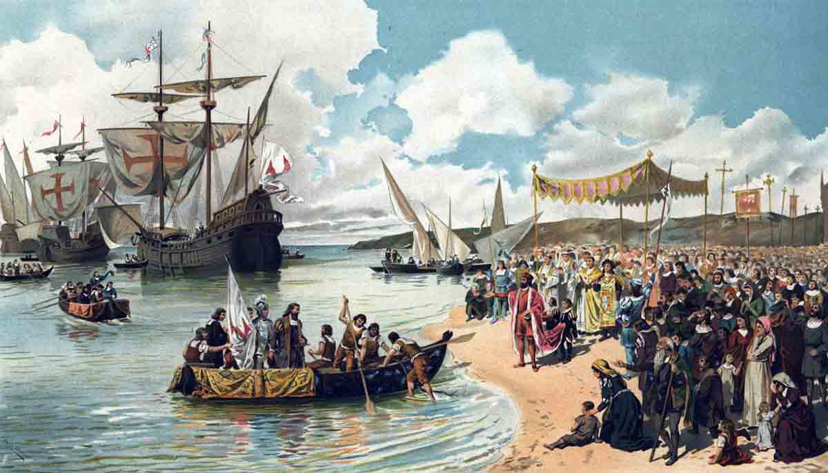
Da Gama launched the expedition on July 8, 1497, with an experienced crew of approximately 160 men. The fleet consisted of four vessels: the São Gabriel, the São Rafael, the Berrio, and a supply ship. They chose to head south across the open ocean rather than hugging the west coast of Africa as Dias had done. They were out to sea for over two months before landing at St. Helena Bay on South Africa’s west coast on November 7, 1497.
They anchored in this large bay for eight days before retreating after a skirmish with local people—da Gama himself was shot in the leg. Their next stop was Mossel Bay, where they stayed for about two weeks before relations with the local herders soured. They then decided to continue east.
Onwards to India
By Christmas Day of 1497, the ships had reached Port St. Johns on South Africa’s east coast. They were well beyond Bartolomeu Dias’ furthest point and on track to complete their objective. At this stage, the men had been at sea for over six months, and supplies had dwindled. Poor nutrition left the crew riddled with scurvy, with many succumbing to malnutrition. They journeyed north through uncharted waters and reached northern Mozambique by the start of March. With the combined efforts of Bartolomeu Dias, Vasco da Gama, and Pêro da Covilhã, the Portuguese had now rounded the entire African coastline.
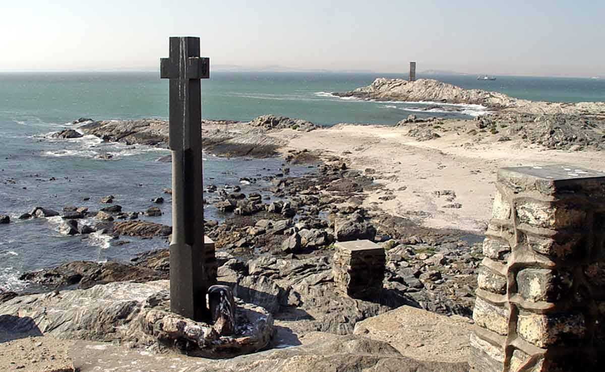
Da Gama and his crew continued north, arriving at Malindi in modern-day Kenya in mid-April 1498. Here, they erected a padrão—now known as the Vasco da Gama Pillar—which still stands today. Their ships anchored at Malindi for twelve days before setting sail for India on April 26.
Three hundred nine days after leaving Portugal, da Gama would reach the city of Calicut on May 20, 1498. The arrival of the Portuguese in India would position them as European leaders in the spice trade. However, the coming centuries saw the start of a ‘Spice War’ involving other European countries such as the Netherlands, England, and Spain.