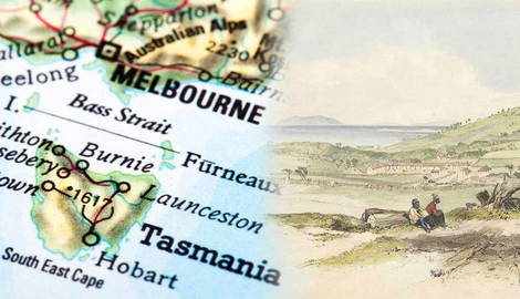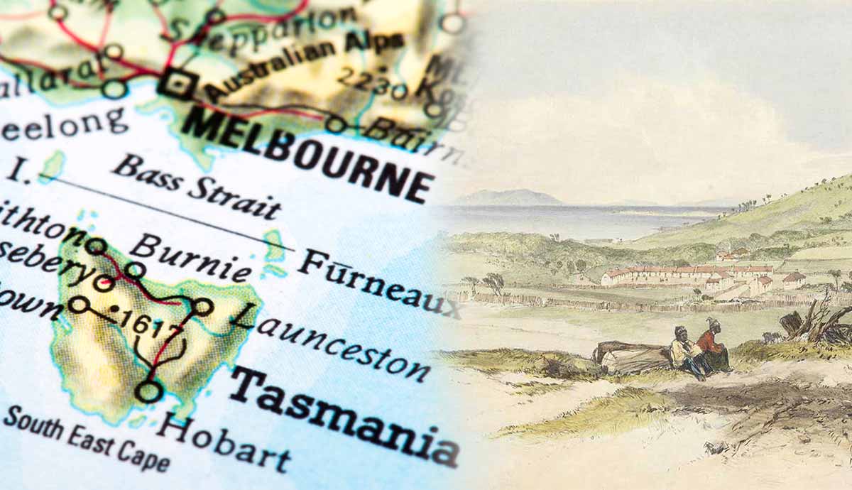
In September 1803, when Aboriginal Tasmanians first encountered British colonists and Tasmania was still known as Trouwunna, Aboriginal society was organized into nine separate nations. The term “nation” was first used in 1875 by colonial ethnographer G.A. Robinson (1791-1866), and is still the one preferred by Aboriginal Tasmanian communities today. Several clans formed each nation, and although each clan was the Traditional Custodian of specific territories, no clan “owned” the land nor maintained exclusive rights to its resources. Today, we only know the name Europeans assigned to each nation. Their ancestral names have been forgotten.
The Big River Nation

In his “Tasmanian tribes,” historian Rhys Jones describes a nation as the grouping of clans “which lived in contiguous regions, spoke the same language or dialect, shared the same cultural traits, usually intermarried, had a similar pattern of seasonal movement, habitually met together for economic and other reasons, the pattern of whose peaceful relations were within the agglomeration and of whose enmities and military adventures were directed outside it.”
Some historians believe that there were between 70 to 85 clans on Tasmanian soil in 1803. Others maintain they were at least 100. Clans tended to have at least two names: the one they identified themselves with and the one that neighboring clans assigned them. Although not the largest by population, the Big River Nation was the largest by territory. They stretched across 8,000 square kilometers (3,088 square miles), including four rivers, the highest mountains on the island, the Great Lake, and many other smaller lakes for a total shoreline of 240 kilometers (82 square miles).

Like the Ben Lomond Nation, the Big River Nation was landlocked and had no direct connection to the sea. Its clans maintained friendly relations with the North West Nation on the west coast and the Oyster Bay Nation on the east, which gave them access to the sea on both sides of the island. Moreover, the river banks provided them with birds for hunting, the plains were abundant with kangaroos, and they could rely on the numerous eucalyptus trees to build huts and spears. In December, people would collect mutton-bird eggs from the rookeries along the northern coast, on the ancestral lands of the North West Nation, the North Nation, the North Midlands Nation, and the North East Nation. Salted carcasses ensured their survival in winter. All of this changed with the arrival of pastoralists in the 1820s.

The Big River Nation, along with the Oyster Bay, South East, and North Midlands nations, witnessed the sharpest and most dramatic decline in its population, largely because of colonial violence and not European-imported diseases. As settlers erected fences for their sheep, clans were increasingly prevented from gathering food or hunting on their ancestral territories. They fought back, plundering settlers’ huts for flour, digging up potatoes from their gardens, and sometimes burning their crops.
In her Tasmanian Aborigines, historian Lyndall Ryan writes that “in the period from 1 December 1827 to 19 March 1828 the settlers in the Clyde police district reported twenty attacks from two Big River clans.” One of the Big River Nation’s most active and respected leaders was Montpelliatta (1790-1836), who led raids and attacks before and during the Black War. Like other Aboriginal leaders, he was sent into forced exile on Flinders Island.
The Southern Nations

To the south, the Big River Nation shared a border with both the South West Nation and the South East Nation. The South West Nation comprised four clans: the Ninene (the Custodians of Port Davey), the Mimegin (Birchs Inlet), the Lowreenne (Low Rocky Point), and the Needwonnee (Cox Bight). They had close relations with their northern neighbors and like them, they lived in small villages of beehive-shaped huts. Their diet comprised mainly seafood (shellfish, crayfish, and seals), as well as small animals like wombats and macropods.
Overall, the ancestral lands of the South West nation stretched along the coast for about 450 kilometers (280 miles), sharing the northern border with the North West Nation. Given the remoteness of their lands, they were among the last to come into contact with British invaders, mainly lumberjacks logging Huon pines at Birchs Inlet and Payne Bay.

In the early 1820s, a whaling station was established around Port Davey. Around the same time, a penal settlement was set up at Macquarie Harbour, and a pilot station at Cape Sorell, on the ancestral lands of the South West Nation. The impact of colonialism was devastating. According to Lyndall Ryan, by 1830 its population had declined to 60 from a previous average of 200-300.
The people of the South East Nation were the most maritime in Tasmania. Hobart was built on the lands of the Mouheneenner Clan. In the summer months, clans converged at Recherche Bay where they would hunt kangaroos, possums, and seals. Ryan notes that they also used to “gather shellfish and a variety of marine and terrestrial vegetable food and to conduct shallow-water scale fishing at night with lighted torches.”
In November, people from various clans congregated at Bruny Island. Back then it was known as lunawanna-allonah and its Custodians were the Nuenonne people. Truganini (1812-1876), who for decades was believed to be “the last Aboriginal Tasmanian,” belonged to the Nuenonne clan.
The Northern Nations

Because the ancestral lands of the North East Nation included 260 kilometers (161 miles) of coastline, Aboriginal historian Patsy Cameron calls them “the Coastal Plains Nation.” Members of the North East Nation didn’t need to travel as much as other clans and nations, because their lands were rich and bountiful. The region was one of estuaries and lagoons, and the diet of the people inhabiting it consisted of both meat (they hunted ducks, swans, and mutton birds) and fish. They often relied on controlled burns (firestick farming) to hunt emus, wallabies, and kangaroos.
By 1815, people of the North East Nation had developed strict and (unsurprisingly) complex relationships with European sealers. In some cases, they married Aboriginal women and settled down with them on the many islands separating Tasmania from mainland Australia in eastern and western Bass Strait. Today, they are known as “Straitsmen.” Their Aboriginal wives called themselves “tyereelore.”
The mountainous rainforest to the south separated the North East clans from the North Midlands and Ben Lomond nations. The people of the North Midlands Nation were among the first to come into contact with the British in 1804 and were and are the Traditional Owners of both the inland and coastal country.
They had access to the sea in the northern part of their ancestral lands, around the Tamar River and the Tamar Valley, where they were bordered by the North and North East nations. Their inland lands stretched as far west as the Great Western Tiers and Quamby Bluff and as far south-east as Tooms Lake, which marks the border with the Oyster Bay Nation. Campbell Town was established in 1821 on the lands of the Tyerrernotepanner clan, who staunchly resisted the settlers’ encroachment on their lands, particularly in the 1820s and 1830s. Most of them died miserably at Oyster Cove and Wybalenna.

The ancestral territory of the Ben Lomond Nation was centered around Ben Lomond Mountain (or Turapina, as it has been known for centuries among Aboriginal people). While the northern border was marked by rainforest, the rest of their territory was covered in forests alternating with open plains and savannah woodlands. Their country was landlocked, meaning it had no access to the sea, although its clans had foraging rights with neighboring nations. Walter George Arthur (1820-1861) was the son of a chief from the Ben Lomond Nation.
Estimates suggest that the North West Nation was the second largest in terms of population. It comprised eight clans, making up between 400 and 600 people. Their ancestral lands extended along the north coast, from present-day Cape Grim to Macquarie Harbour. They encompassed Robbins and Hunter islands, where people would go to catch mutton birds, seal, and collect abalone shells, which they would then place around their small wells for travelers to drink from.

The North Nation is today known among historians as the “Ochre Nation.” It comprised four clans, which were the Custodians of several ochre mines at St Valentines Peak, Gog Range, Mount Vandyke, and Mount Housetop. All of them were connected by a system of ancestral tracks that people kept clean and open by applying a carefully planned system of controlled burns.
In the 1830s, the North West and North clans fought hard against the Van Diemen’s Land Company (VDL), the farming corporation that was partly responsible, among other things, for the extinction of the Tasmanian tiger. In 1825, the colonial government granted VDL more than 200,000 hectares to graze sheep between Port Sorell and Cape Grim, including several ochre mines and kangaroo hunting grounds sacred to the local Aboriginal clans and, most importantly perhaps, necessary to their survival.
The North Nation also had to defend their lands from another powerful enemy, the cattle barons in the east. The Pallittorre Clan was the one who suffered the most. In the late 1820s, they fought strenuously to protect the Western Marshes, one of their kangaroo hunting grounds. They carried out several attacks against the colonists’ properties, “stealing” bags of wheat, flour, and salt, and then destroying what they could not take away. Many of them were massacred in reprisal killings. With the help of the 40th Regiment, heavily armed stockmen killed about 100 of them over four nights in January 1827. In 1826, the North Nation counted around 400 people. In 1830, fewer than 60 could be accounted for.
Oyster Bay Nation

The Oyster Bay Nation was the largest in terms of population. It consisted of at least ten clans and counted between 700 and 800 members. Their territory ran along the east coast from the Derwent estuary to St Patricks Head, including the River Derwent, the mouth of Jordan River, the so-called York Plains, and Crown Lagoon. The first British settlement on Tasmanian soil was established at Risdon Cove, on the east bank of the River Derwent, in 1803.
A family of the Moomairremener Clan was the first to sight the first British ship at Risdon Cove in September 1803. The ship, under the command of Lieutenant John Bowen of the Royal Navy, carried 49 people (including male and female convicts, three families, and naval surgeon and magistrate Jacob Mountgarrett). In February 1804, a group of Moomairremener and Nuenonne saw two more ships on the River Derwent.

This time they carried some 200 British colonists. Among them, there were 100 male convicts and various marines with their families. The British invasion had just begun. The coming of pastoralists in 1817 profoundly disrupted Aboriginal routes and seasonal movements. In the months leading up to the Black War, the lands of the Oyster Bay nation became known as the “Settled Districts.”
At the very start of the conflict, during the summer of 1826-27, clans of the Oyster Bay, Big River, and North Midlands nations carried out several attacks on the settlers and stock-keepers who refused to vacate their ancestral hunting grounds. To put it with Lyndall Ryan, they “not only fought back; they made the purpose of their attacks quite plain: to acquire food and force the colonists to leave their hunting grounds.”

William Lanney (1835-1869) was the last “full-blood” male and the last surviving male of the Oyster Cove Clan. Also known as William Lanne and King Billy, he belonged to the Moomairemener clan of the Oyster Bay Nation and was born at Coal River. He arrived at the Wybalenna Aboriginal camp on Flinders Island in 1842. When he died of cholera and dysentery in March 1869, his body was brutally dismembered by William Crowther, a member of the College of Surgeons, and by members of the Royal Society in the course of a dispute as to who should have his remains. According to some sources, he was Truganini’s third partner.
Another important member of the Oyster Bay nation was Tongerlongeter (1790-1837), a leader of the Poredareme Clan who led several attacks on settlers during the Black War and the Black Line months. Today, Australia is finally beginning to acknowledge the importance of figures such as Truganini, William Lanney, Tongerlongeter, Walter George Arthur, and Montpelliatta in the history of Tasmania.
