The Han Dynasty (202 BCE – 220 CE) was the second imperial dynasty of China, succeeding the Qin Dynasty. Often considered a golden age in Chinese history, the era was marked by significant economic prosperity, the expansion of the empire’s territory, the establishment of the Silk Road trade network, and the adoption of Confucianism as the official state ideology.
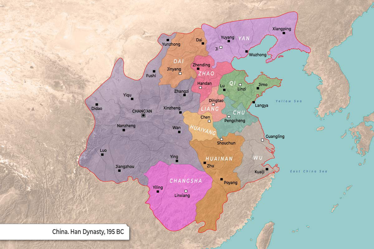
The map displays the political divisions of China during the early Han Dynasty in 195 BC.
- The map contrasts a large, directly administered western imperial region (shaded purple) with a fragmented eastern region composed of numerous semi-autonomous kingdoms.
- Each of the eastern kingdoms is designated by a distinct color to denote its regional boundaries.
- Significant cities are marked with black squares, while the administrative capitals of the kingdoms feature squares with white centers.
| Kingdom / Region | Geographic Position | Marked Cities |
| Western Imperial Region | West / Central |
Chang’an, Didao, Yiqu, Fushi, Yunzhong, Luo, Jiangzhou, Nanzheng, Wan, Xinzheng, Ying
|
| Yan | Northeast |
Ji, Yuyang, Wuzhong, Xiangping
|
| Dai | North |
Jinyang, Dai
|
| Zhao | North Central |
Handan, Zhending, Zhangzi
|
| Qi | East |
Linzi, Jimo, Lu, Langya
|
| Liang | Central |
Dingtao
|
| Chu | East |
Pengcheng
|
| Huaiyang | Central |
Chen
|
| Huainan | Central |
Shouchun, Zhu
|
| Wu | Southeast |
Guangling, Kuaiji, Poyang
|
| Changsha | South |
Linxiang, Yiling
|