New Orleans is one of the most unique cities in the United States of America. Founded in 1718 with the construction of the French Quarter, located on a relatively high point. New Orleans then exchanged several hands throughout its 300 years as a colonial European city between the French, Spanish, and Americans. However, the land New Orleans was built on had served as an important trade hub for thousands of years for Native Americans before Europeans ever showed up. The city lies on the mouth of the Mississippi River, creating a chokehold of access to the interior of the North American Midwest from one single point. But it is this geography that has empowered the city, which suggests its future doom of sinking into the earth below the waves.
Prelude to Doom

In 2005, Hurricane Katrina tore apart New Orleans. The flooding began in the Lower 9th Ward when two levee walls fell. Some homes were tossed off their foundations. Then, the levee north and east of the Lower 9th ward failed, allowing the wetlands to become filled with Katrina’s wrathful waters. Soon after, Eastern New Orleans became completely engulfed by floodwaters on all sides.
About a half hour after that, levees on the northern side of New Orleans, which sit on the southern bank of the enormous Lake Pontchartrain, began failing. Then, in the Upper 9th Ward a bit later, flooding deluged that section of the city. Around the same time, levees on Lake Pontchartrain were simply pushed over by the flood of water. Then, the rest of the land directly connected to the Lower 9th Ward on the eastern end began filling with flood water. This went on with more flooding all along the rest of the northern side of New Orleans along the lake. The center of the city, noted by the fluffy white cloud in the picture above, is the last place to be filled with water by midday of Hurricane Katrina’s landing.
This begs the question, why is such a major city so prone to such a damaging flood?
The answer lies in topography. Upon a quick inspection of a topographical map of New Orleans, it is easy to see that a majority of the city acts as a bowl. But it wasn’t originally built to be so.
Swampy Beginnings in the French Quarter

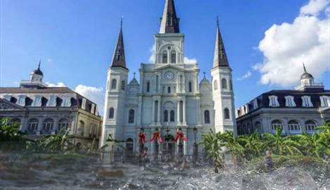
The map above is the original New Orleans. In fact, it was the only New Orleans for about 70 years, from its inception in 1718 until around 1788. This small, planned grid called the French Quarter was in a great location for the area. It is directly on the banks of the Mississippi, but even so, it is relatively high compared to the wetlands and swamps of most of New Orleans and its surrounding areas. The Mississippi can actually be seen in the map above, directly adjacent to the small half-square mile of the city. For reference, Central Park in New York City is about one and a quarter square miles. The French Quarter’s location on the banks it was chosen to sit on is also due to its ease of access to Lake Pontchartrain. Access to the lake was provided by Bayou St. John, which was safer than the Mississippi for shipping.
The French Quarter, and thus New Orleans, was founded by Jean-Baptiste Le Moyne, Sieur de Bienville. Bienville commented on the city’s location in his own words:
“[T]he capital city…is advantageously situated in the center of the French plantations, near enough to receive [their] assistance…and reciprocally to furnish the settlers with the things they need…from its warehouses. Bayou St. John which is behind the city is of such great convenience because of the communication which it affords with Lake Pontchartrain and consequently with the sea that it cannot be esteemed too highly.”
The quote brings in another aspect of why Bienville chose the location he did for the French Quarter, which was its location near French Plantations. Bienville did not note, however, that he owned lots of land nearby and would benefit from fostering the growth of settlements in the area.

As can be seen in the topographical map above, Bienville picked a great area for the time, both geographically and strategically. If Bienville had located the city more downriver, its core would have been much more vulnerable to flooding and, thus, hurricanes. A French observer had noted that the location of the French Quarter was just about perfect. François Marie Perrin Du Lac said that if the city had been located on even higher ground, it would be too far from the sea.
Thus, moving it upstream was not a great decision. That would also relinquish control of the entirety of the Mississippi River basin and its tributaries, which is about equivalent to the territory sold during the Louisiana Purchase by the United States from Napoleon. The observer noted again that if the city were founded any lower, such as towards the mouth of the Mississippi, it would flood, as data and maps suggest time and time again.
In fact, New Orleans was so greatly placed that when Hurricane Katrina hit, all of the historical areas, including the French Quarter, were not flooded. New Orleans was not meant to fan out and build into the bowl; it was meant to stay along the high banks of the Mississippi. And while Bienville did place the city of New Orleans at the perfect spot for his time, the hubris of constructing on wetlands and floodplains has evolved into a new issue that Bienville likely could have never even comprehended for his perfectly-placed city. That unforeseeable problem was the weak, swampy ground collapsing underneath the city itself.
The Sinking of New Orleans

The unfortunate reality of New Orleans is that it may very well become the Atlantis of legends. As the city has grown enormous, so has the hubris of defying nature’s tendencies. As mentioned earlier, historical areas of the city did not flood at all during the catastrophe of Katrina. Yet, even places like the French Quarter can be seen sinking directly into the earth. It is a small amount of around 4.5 millimeters a year, but that is plenty to disrupt foundations in the near future. Some areas, such as those near the wetlands of Lower 9th Ward in the center-right of the map, are sinking at greater velocities of 10-20 millimeters a year! This is also the location where Hurricane Katrina first flooded in 2005.
This sinking does not even consider climate change, where, if sea levels rose due to global warming, it is hard to believe that much of New Orleans would survive. However, that effect can affect coastal cities and towns across the entire planet. If the sinking is not related to climate change, then what is it related to?
According to the Jean Lafitte and Jazz National Parks Visitors Center in New Orleans, New Orleans lies at the mouth of the largest river system in the continental United States. This system carries eroded materials, minerals, and other substances from a dozen or so states all to one place before flushing out into the sea. If there is any place for those little particles from thousands of acres of land to build up, it is at the mouth of the river.

To put it simply, New Orleans and most development towards the mouth of the Mississippi River is built on mud. When the river floods and brings particles and substances to higher grounds which could have been carried from as far away as the furthest tributary. These particles fall and layer and create sediments. These sediments have been built up inch by inch for thousands of years. But the ground is still essentially mud, quite unlike the sturdy ground of the inner continent.
There are also a few reasons that building on mud is highly discouraged; the first among them is that it is structurally unstable. The average person knows what it’s like to step and slide in mud. How easy would it be for a multi-ton structure made of concrete, steel, wood, or a combination of the three to slide and sink?
As culturally unique as New Orleans is, being the epicenter of jazz and having a culture stemming from its French, Spanish, and American roots, much of the city does not necessarily have a bright future. Most of its land has continually been found to be sinking into the earth. It is prone to the very flooding that nature has used for thousands of years to create new land, and if climate change continues in the direction that scientists believe, it will simply continue to grow deeper and deeper underwater. There will be no need to search for Atlantis any longer; it will exist in the city of New Orleans, Louisiana.