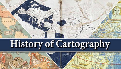
Cartography is a rich and vast discipline that spans thousands of years, from the ancient world, with the Babylonians, Egyptians, and Greeks creating maps to navigate and survey the world, to the modern and contemporary world, with fascinating advances in technology that continue to expand the frontiers of cartography. Maps of space and the seafloor that are technologically possible today are, in essence, no different from the illustrated, fantasy-like maps of the past, for cartography seeks to understand and communicate reality through representation. Maps and projections allow us to know more about our world through the study of our surroundings.
Cartography in the Ancient Times

The art and science of mapmaking began thousands of years ago. Though some map-like representations come from prehistory, they’re hardly true maps. Instead, in the early cradles of civilization, cartography began to take place out of a necessity for knowledge of their surroundings and sailing. In the Near East, Babylon led the way with accurate surveying techniques, while Phoenicia led in seafaring and exploration. Some of these first maps show a major trend in cartography: the diverse depiction of reality.
The Babylonian Map of the World, as seen below, shows a symbolic representation that isn’t too worried about portraying the world in a technical and precise manner; rather, the map seeks to represent the world according to the Babylonian understanding and appreciation of their known world. The depiction of Babylon in its World Map shows Babylonian territory in a circular shape surrounded by water, an incorrect geographical model that nevertheless fits with the religious understanding of its world.

Meanwhile, Phoenician undertakings were noticeably more concerned with accuracy and precision. Seafaring was a dangerous and complicated task; thus, the appreciation of geography was more in sync with navigation and exploration. It has been suggested that the Phoenicians may have even known about the Earth’s curvature, though no certainty remains.
This diversity in representation can be seen throughout all early cartographical depictions. Oftentimes, these early depictions showed the known world of each civilization according to their conception of Earth and their place in it. The Ancient Greeks, for example, also believed the world to be a disk surrounded by an Ocean, a great river that encircled the world. Greece lay in the central region of Earth, and the edges were inhabited by barbarians and monsters, subjects of mythology.
The Evolution of Cartography & the Middle Ages

Cartography spread and developed in much of the Near East and Europe. The Roman Empire was built upon the work of the Persians and Greeks. Soon, the Mediterranean had been fully mapped to a surprising accuracy. Around the same time, in the Far East, China and India were beginning their own attempts at cartography. Constellation charts were used for navigation, while maps detailing settlements and geography were also created in India. In China, cartographical endeavors began as far back as the 5th century BCE. Much like other cases, naval exploration played an important role in the development of Chinese cartography.
Like the Romans and Greeks, the Islamic world in the Near East built upon the cartographical traditions of their predecessors. By the Middle Ages, Muslim scholars had successfully continued and advanced the mapmaking efforts started in Mesopotamia and followed up on during the Hellenic conquests. While Medieval Europe underwent its “Dark Ages,” the Islamic world enjoyed a period of great scholarship under its Golden Age.
Or so we believed. Although the Islamic world did enjoy great flourishment in science and culture, the notion that Europe underwent a period of “great darkness” is generally considered untrue by today’s standards.

Thus, both European and Islamic medieval cartography experienced a great deal of development and advancement. Islamic atlases combined the knowledge obtained from Arab merchants and explorers with the knowledge left by Classical cartographers and scholars such as Claudius Ptolemy and his Geographia.
In Europe, Mappa Mundis (maps of the world) became commonplace. Many types exist, like the T-O, Zonal, Quadripartite, and Complex. Some of the most notable are the Hereford Mappa Mundi and the Fra Mauro Map. One of the largest Complex Mappa Mundi was the Ebstorf Map, which was destroyed during World War II.
Cartography in the Age of Exploration

Following the Middle Ages, the Early Modern period saw the Age of Exploration from the 15th to the 17th century. During said time, cartography continued to evolve thanks to the discoveries and knowledge gained by European explorers in their travels to the Americas, Africa, and the Far East. Thanks to the Renaissance, classical works gained new attention, and maps became more like surveys once more. This approach to cartography brought upon some of the most accurate and detailed maps to date, with the represented world reaching more familiar shapes to what we know today.
The explorations of the world, such as the Columbian expeditions and Magellan’s circumnavigation, provided major amounts of information about the world, which now was separated into the Old and New Worlds, highlighting the significance of the encounters and discoveries. The world known to the Europeans was each time more real and true to geography and the physical reality of Earth.
And though many times subject to myths and legends, such as the Island of California, discoveries were quickly introduced into the mainstream. Soon, the lands once considered part of Asia were discovered to be truly part of their own continent. Such developments were effectively communicated through cartography. Columbus’ and Vespucci’s explorations, for example, served to create the first map to ever refer to the New World as “America,” thanks in great part to the cartographer. The accounts of explorers were represented in maps and projections, which, in turn, after the invention of the press and mass printing, were made available to the greater populace.
The Evolution of Cartography into the Modern Era

By the 18th century, the world according to maps looked very much like what we know today. The true geography of the world was mostly correctly translated to cartography. By the 19th century, maps looked almost exactly like they do today. Cartography thus reached a point where, thanks to science and technology, accurate and correct depictions of Earth were possible, easily produced, and readily available. The known world was no longer just northern Africa, the Near East, and northern Greece, as it was for the Ancient Greeks. Instead, most of what was on Earth became known.
But one issue remained. Even the most modern and advanced depictions could not truly represent the world in the exact form as its physical form. As the Earth is spherical, the translation into a 2D form is subject to distortion. Perhaps one of the most famous cases of such occurrence is the Mercator projection, which famously represents northern and southern portions of the world as greater in size than those near the equator. The projection also tends to place Europe in the center of the map, thus subject to accusations of Eurocentrism. Detailed knowledge of the world and a favorable disposition to Europe was not uncommon for the 19th-century world dominated by imperialism and colonialism.
Earth’s curvature makes it impossible to represent the world one-to-one, yet each different projection provides a distinct way to look at the world. Likewise, other forms of representation, like globes, better depict the world by taking into account the spherical nature of the Earth. New technologies were fundamental for these advancements, with new and applied knowledge in Earth sciences, improvements in existing technology, and new processes.
Contemporary Cartography

Contemporary cartography is a dynamic and exciting field. Unlike cartography in the past, the field is now, more than ever, increasingly available, interactive, participatory, and accessible. While an expert field at its core, the basic general features of cartography are open to most and generally understood by many. Technology, such as GPS, follows us in our daily lives through smartphones. Other technologies, such as Geographical Information Systems (GIS), may lie hidden among other more marketable features and yet are equally useful and surprisingly accessible for most people. Courses on GIS technology, for example, can be found quite easily on the internet, with skills proving more and more useful in the highly-technological world we live in today.
Cartography has evolved dramatically throughout the years, from its humble beginnings as a discipline involved mostly with surveying and navigation to its modern advanced standards that continue to show us what’s possible when it comes to knowing our world better. At first glance, the world may seem fully discovered, but new technologies allow us to look at specific details with distinct lenses showing us a new side of our world and our surroundings. Satellite imagery and other real-time data show us true-to-life depictions of Earth and even foreign places out in the universe.
Mapmaking may no longer be the field associated with the artistry and almost magic-like creation it once had in the earlier centuries. Yet its essence remains largely the same, a field dedicated to discovering and communicating the world through interesting and compelling depictions that allow us to better understand and appreciate it.